MyTopo
Lake Andes NW South Dakota US Topo Map
Couldn't load pickup availability
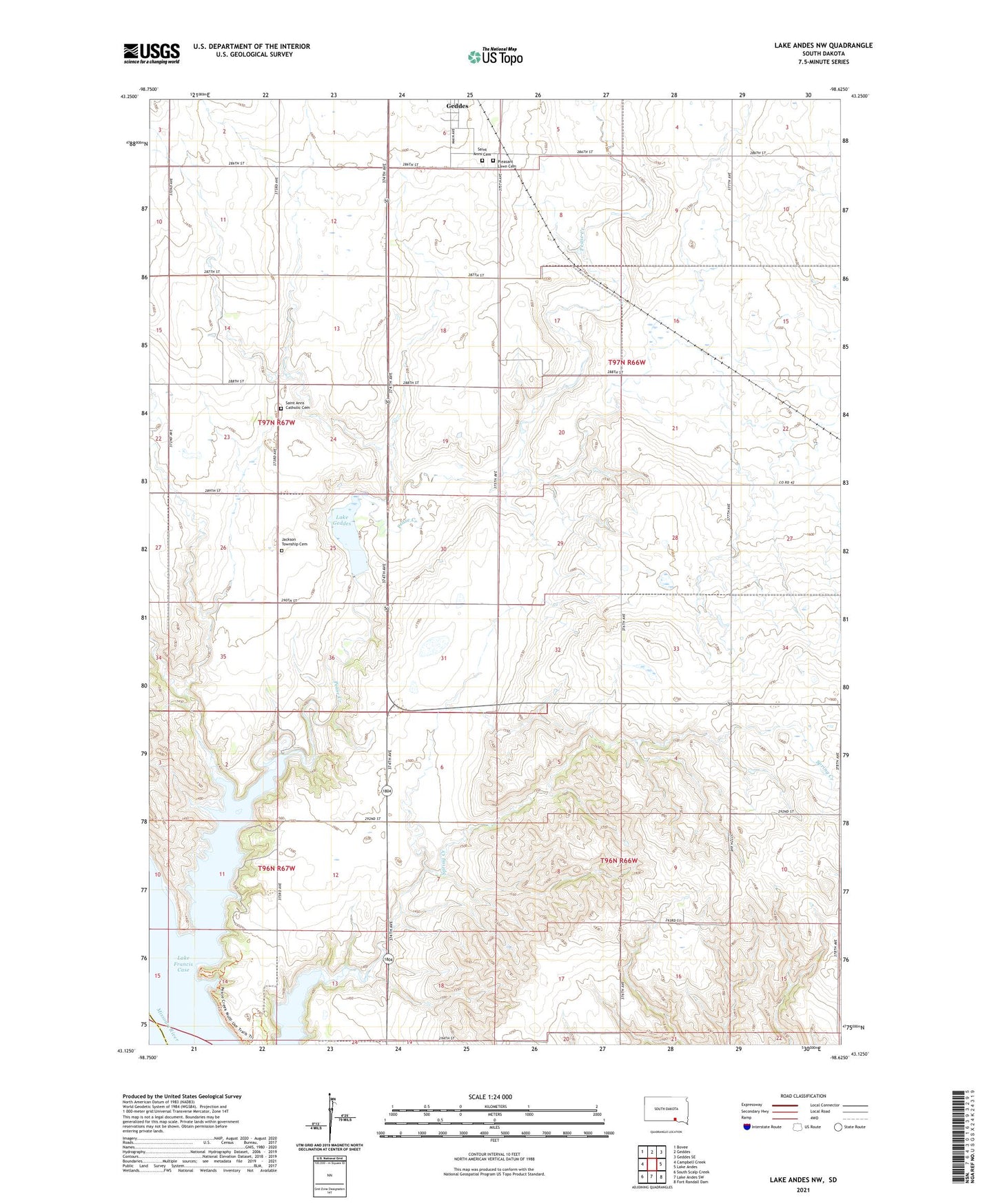
2021 topographic map quadrangle Lake Andes NW in the state of South Dakota. Scale: 1:24000. Based on the newly updated USGS 7.5' US Topo map series, this map is in the following counties: Charles Mix, Gregory. The map contains contour data, water features, and other items you are used to seeing on USGS maps, but also has updated roads and other features. This is the next generation of topographic maps. Printed on high-quality waterproof paper with UV fade-resistant inks.
Quads adjacent to this one:
West: Campbell Creek
Northwest: Bovee
North: Geddes
Northeast: Geddes SE
East: Lake Andes
Southeast: Fort Randall Dam
South: Lake Andes SW
Southwest: South Scalp Creek
Contains the following named places: Bartholdi, Geddes Dam, Jackson Township Cemetery, Lake Geddes, Pease Creek, Pease Creek Recreation Area, Pleasant Lawn Cemetery, Saint Anns Catholic Cemetery, Saint Anns Cemetery, Spring Creek Recreation Area, Township of Jackson, Varilek Fishpond Number 1 Dam, Varilek Fishpond Number 2 Dam, Varilek Fishpond Number One, Varilek Fishpond Number Two, ZIP Code: 57342