MyTopo
Medicine Mountain South Dakota US Topo Map
Couldn't load pickup availability
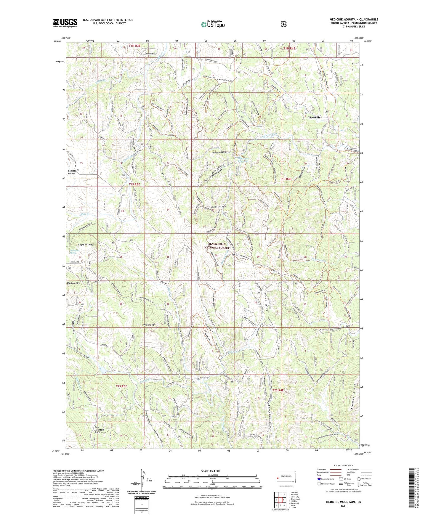
2021 topographic map quadrangle Medicine Mountain in the state of South Dakota. Scale: 1:24000. Based on the newly updated USGS 7.5' US Topo map series, this map is in the following counties: Pennington. The map contains contour data, water features, and other items you are used to seeing on USGS maps, but also has updated roads and other features. This is the next generation of topographic maps. Printed on high-quality waterproof paper with UV fade-resistant inks.
Quads adjacent to this one:
West: Ditch Creek
Northwest: Deerfield
North: Rochford
Northeast: Silver City
East: Hill City
Southeast: Custer
South: Berne
Southwest: Signal Hill
Contains the following named places: Bear Mountain Basin, Bobcat Gulch, Boutwell Ranch, Brushy Draw, BSA Dam, Coad Hill, Coon Creek, Copper Mountain, Frink Draw, Gillette Prairie, Gillettes Ranch, Gooseberry Draw, Huckens Ranch, Jackson Ranch, Little Thompson Draw, Long Draw, Marble Creek, Mastiff Mine, Medicine Mountain, Medicine Mountain Ranch, Negro Creek, Reno Gulch Park, Reno Gulch Reservoir, South Slate Creek, South Slate School, Strickland Spring, Sunflower Mine, Thompson Draw, Thompson Reservoir, Tigerville, Tree Draw, Western Feldspar Mine