MyTopo
Rattlesnake Lake SE South Dakota US Topo Map
Couldn't load pickup availability
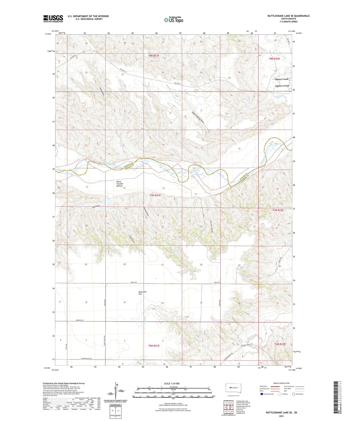
2021 topographic map quadrangle Rattlesnake Lake SE in the state of South Dakota. Scale: 1:24000. Based on the newly updated USGS 7.5' US Topo map series, this map is in the following counties: Haakon, Ziebach. The map contains contour data, water features, and other items you are used to seeing on USGS maps, but also has updated roads and other features. This is the next generation of topographic maps. Printed on high-quality waterproof paper with UV fade-resistant inks.
Quads adjacent to this one:
West: Rattlesnake Lake SW
Northwest: Rattlesnake Lake
North: Rattlesnake Lake NE
Northeast: Cherry Creek NW
East: Cherry Creek
Southeast: Middle Draw
South: Murray Draw
Southwest: Milesville
Contains the following named places: Beerwagon Spring, Bergen Dam, Big Draw, Curtis Draw, Eagle Chasing Draw, Helster Draw, Malone School, Spring Draw, Staben Strip, Swan Draw, Westfork, White Thunder Bottom, White Thunder Ranch