MyTopo
Rattlesnake Lake South Dakota US Topo Map
Couldn't load pickup availability
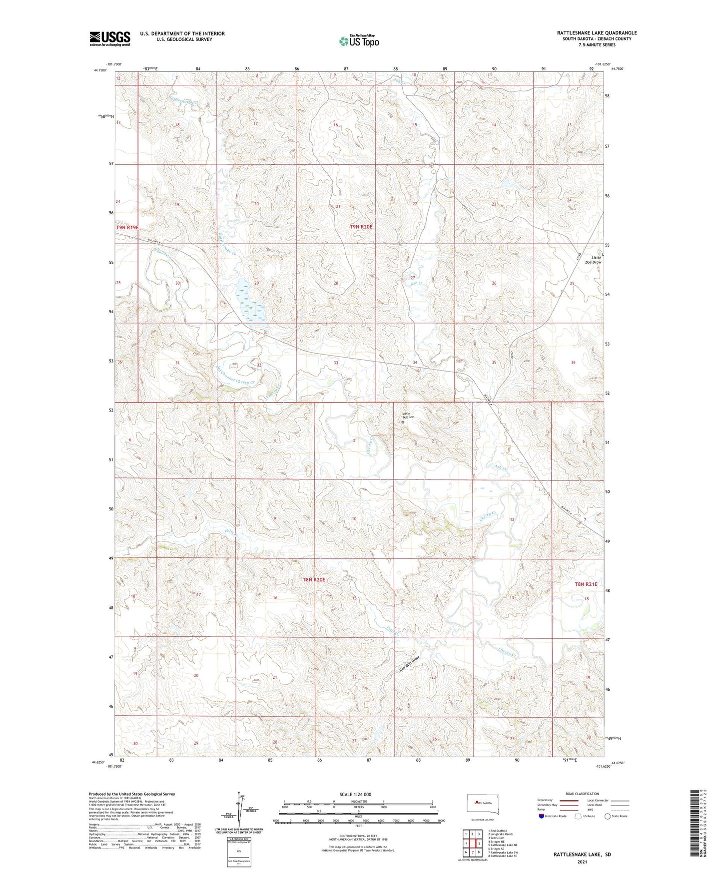
2021 topographic map quadrangle Rattlesnake Lake in the state of South Dakota. Scale: 1:24000. Based on the newly updated USGS 7.5' US Topo map series, this map is in the following counties: Ziebach. The map contains contour data, water features, and other items you are used to seeing on USGS maps, but also has updated roads and other features. This is the next generation of topographic maps. Printed on high-quality waterproof paper with UV fade-resistant inks.
Quads adjacent to this one:
West: Bridger NE
Northwest: Red Scaffold
North: Longbrake Ranch
Northeast: Sears Dam
East: Rattlesnake Lake NE
Southeast: Rattlesnake Lake SE
South: Rattlesnake Lake SW
Southwest: Bridger SE
Contains the following named places: Ash Creek, District 3, Felix Creek, Frazier Church, Jesse Dam, Knight Ranch, Little Dog Cemetery, Little Dog Dam, Old Channel Cherry Creek, Rattlesnake Creek, Rattlesnake Lake, Red Bull Draw, Samuelson Ranch