MyTopo
Saint Charles South Dakota US Topo Map
Couldn't load pickup availability
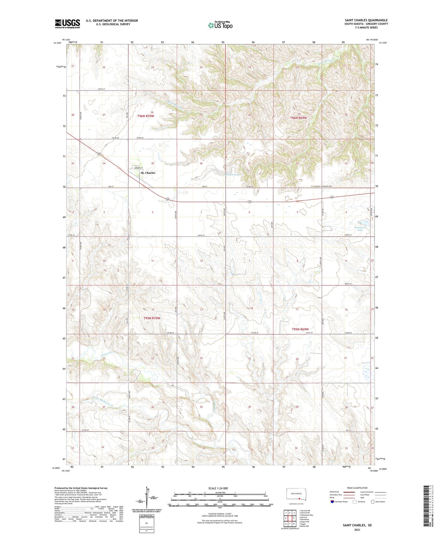
2021 topographic map quadrangle Saint Charles in the state of South Dakota. Scale: 1:24000. Based on the newly updated USGS 7.5' US Topo map series, this map is in the following counties: Gregory. The map contains contour data, water features, and other items you are used to seeing on USGS maps, but also has updated roads and other features. This is the next generation of topographic maps. Printed on high-quality waterproof paper with UV fade-resistant inks.
Quads adjacent to this one:
West: Herrick
Northwest: Herrick NW
North: Herrick NE
Northeast: Whetstone Bay
East: Bonesteel
Southeast: Butte NW
South: Naper
Southwest: Naper NW
Contains the following named places: Bonesteel Lake, Bonesteel Lake Dam, Haisch Lake, Leonard Ziesier Number 1 Dam, Logan Thoene Number 1 Dam, Oscar Micheaux Creek, Oscar Micheaux Reservoir, Saint Charles, Saint Charles Census Designated Place, The Burnt Rock, Township of Ellston, Township of Saint Charles, ZIP Code: 57571