
MyTopo
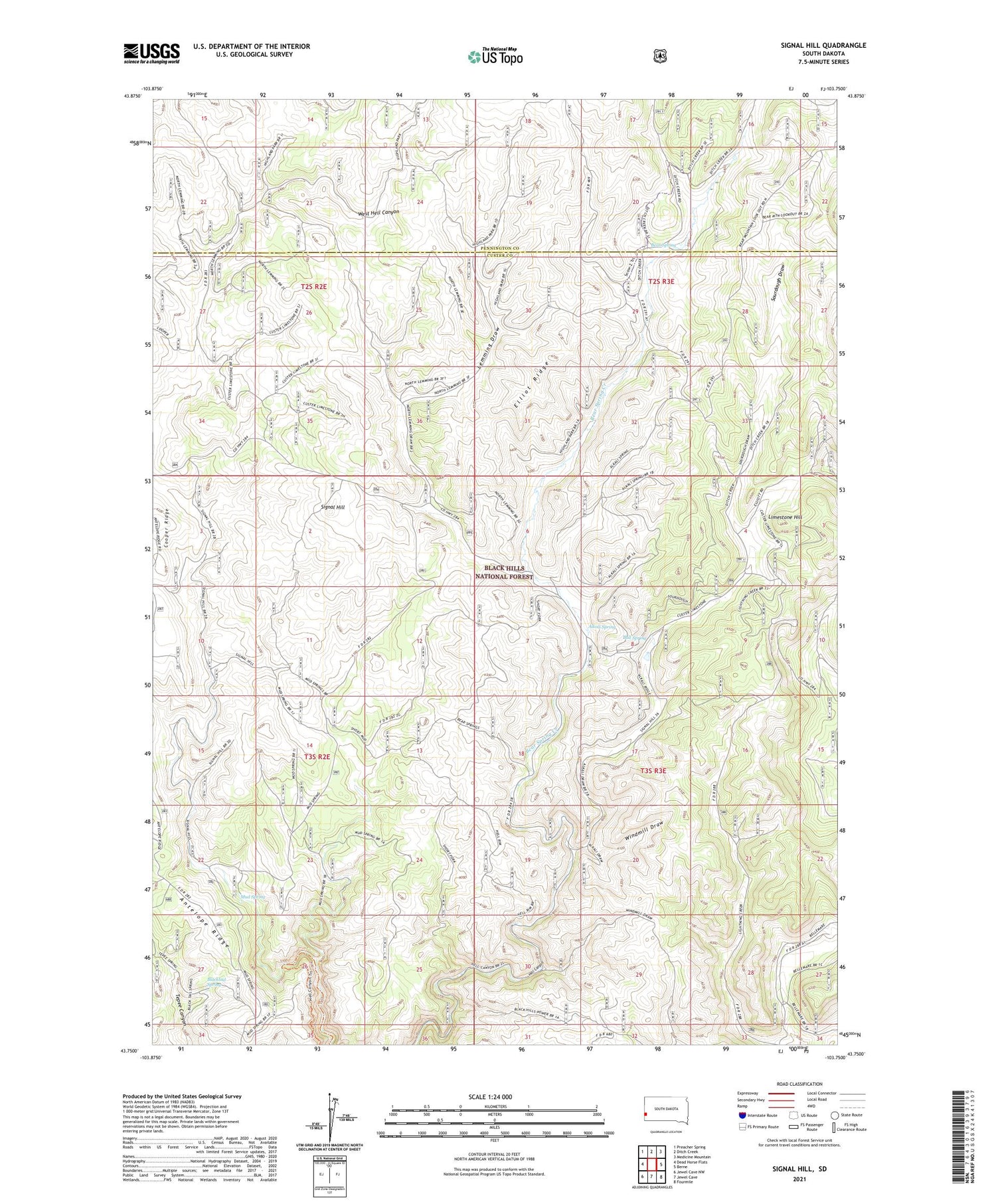
Signal Hill South Dakota US Topo Map
Couldn't load pickup availability
2021 topographic map quadrangle Signal Hill in the state of South Dakota. Scale: 1:24000. Based on the newly updated USGS 7.5' US Topo map series, this map is in the following counties: Custer, Pennington. The map contains contour data, water features, and other items you are used to seeing on USGS maps, but also has updated roads and other features. This is the next generation of topographic maps. Printed on high-quality waterproof paper with UV fade-resistant inks.
Quads adjacent to this one:
West: Dead Horse Flats
Northwest: Preacher Spring
North: Ditch Creek
Northeast: Medicine Mountain
East: Berne
Southeast: Fourmile
South: Jewel Cave
Southwest: Jewel Cave NW
Contains the following named places: Alkali School, Alkali Spring, Antelope Ridge, Bear Spring, Bear Spring Creek, Blacktail Spring, Blacktail Well, Bull Spring, Cooper Ranch, Doll Ranch, Elliot Ranch, Elliot Ridge, Gahl Ranch, Hammock Ranch, Lemming Draw, Lemming Well, Limestone Hill, Mud Spring, Short Fork, Signal Hill, Sourdough Draw, Sturm Ranch, Windmill Draw, Yount Ranch


