MyTopo
Wakonda South Dakota US Topo Map
Couldn't load pickup availability
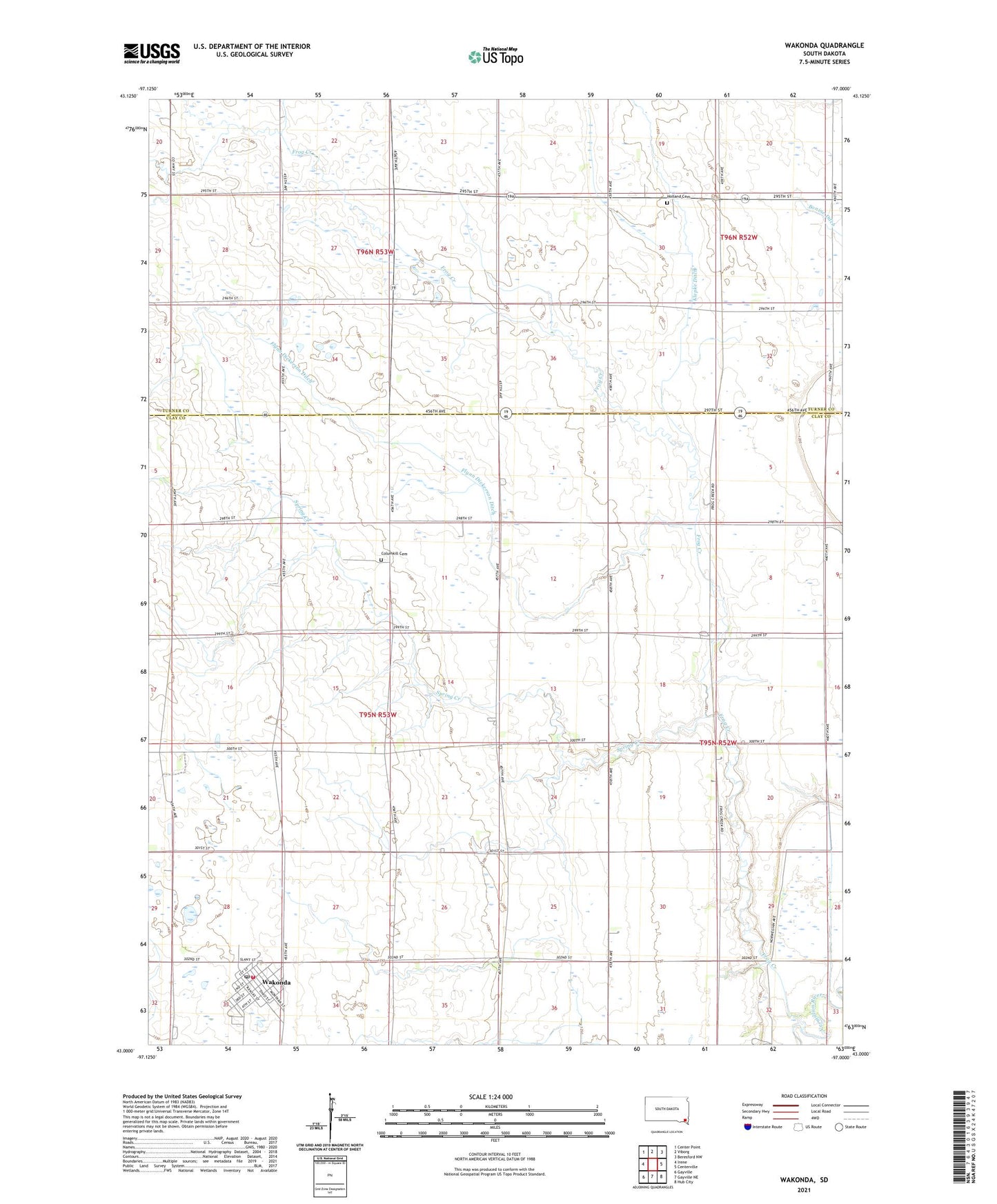
2021 topographic map quadrangle Wakonda in the state of South Dakota. Scale: 1:24000. Based on the newly updated USGS 7.5' US Topo map series, this map is in the following counties: Clay, Turner. The map contains contour data, water features, and other items you are used to seeing on USGS maps, but also has updated roads and other features. This is the next generation of topographic maps. Printed on high-quality waterproof paper with UV fade-resistant inks.
Quads adjacent to this one:
West: Irene
Northwest: Center Point
North: Viborg
Northeast: Beresford NW
East: Centerville
Southeast: Hub City
South: Gayville NE
Southwest: Gayville
Contains the following named places: Bellview School, Colfax Corner, Columkill Cemetery, Flynn Dickerson Ditch, Frog Creek, Frog Creek School, Hagamon Spring, Holland Cemetery, Immanuel Church, Ireland School Number 54, Irene-Wakonda Elementary School, Klepke Ditch, Lake Montogomery, Lake Wakonda, Mount Pleasant School Number 32, Riverside, Saint Collumbkille Catholic Church, Shaw School, Spring Creek, Star Corner, Star Corner School, Town of Wakonda, Township of Star, Wakonda, Wakonda Fire and Rescue, Wakonda Post Office, Wakonda Public Library, ZIP Code: 57073