MyTopo
Wall South Dakota US Topo Map
Couldn't load pickup availability
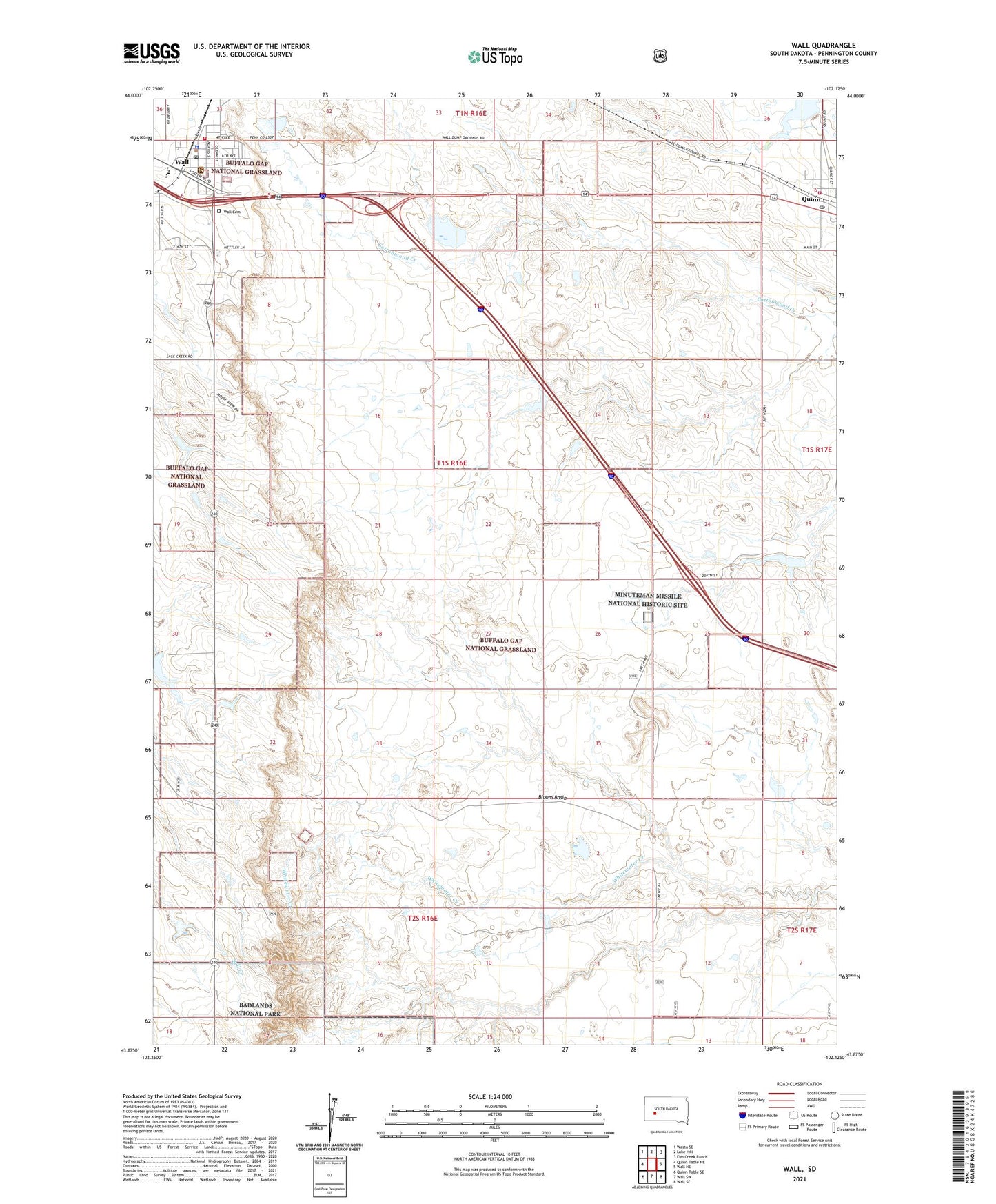
2021 topographic map quadrangle Wall in the state of South Dakota. Scale: 1:24000. Based on the newly updated USGS 7.5' US Topo map series, this map is in the following counties: Pennington. The map contains contour data, water features, and other items you are used to seeing on USGS maps, but also has updated roads and other features. This is the next generation of topographic maps. Printed on high-quality waterproof paper with UV fade-resistant inks.
Quads adjacent to this one:
West: Quinn Table NE
Northwest: Wasta SE
North: Lake Hill
Northeast: Elm Creek Ranch
East: Wall NE
Southeast: Wall SE
South: Wall SW
Southwest: Quinn Table SE
Contains the following named places: Bloom Basin, Bud Bloom Dam, Buffalo Gap National Grassland, Ed Frien Dam, Indian Village Landing Strip, Maco Sica Picnic Ground, National Grasslands Visitors Cnter, Pinnacles Ranger Station, Quinn, Quinn Dam, Quinn Post Office, Quinn Volunteer Fire Department, Town of Quinn, Town of Wall, Township of Fairview, Wall, Wall Cemetery, Wall City Office, Wall Community Center, Wall Community Library, Wall Electronic Site, Wall Elementary School, Wall High School, Wall Middle School, Wall Police Department, Wall Post Office, Wall Volunteer Ambulance Service, Wall Volunteer Fire Department Station 1, Wounded Knee Museum