MyTopo
Silerton Tennessee US Topo Map
Couldn't load pickup availability
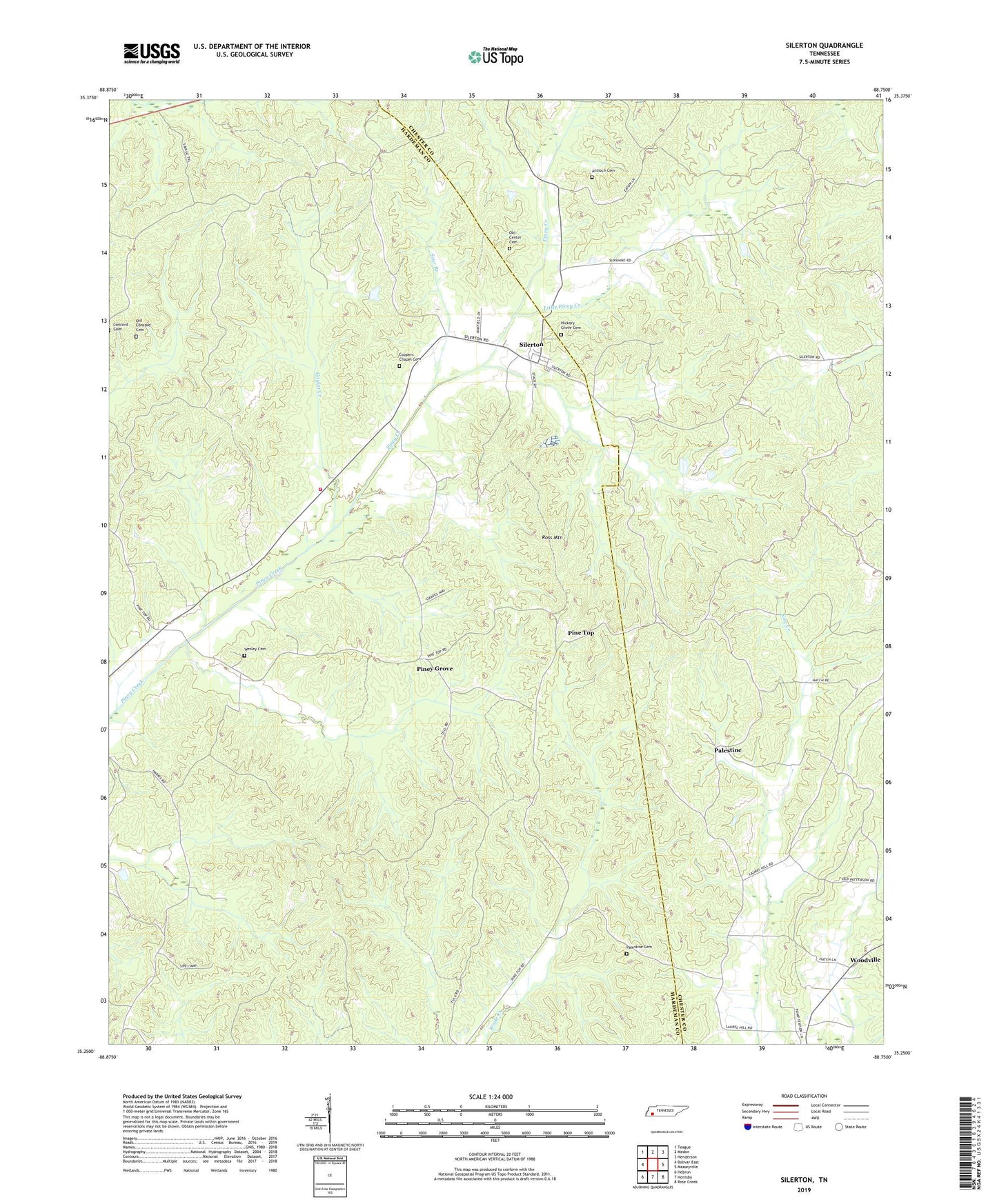
2019 topographic map quadrangle Silerton in the state of Tennessee. Scale: 1:24000. Based on the newly updated USGS 7.5' US Topo map series, this map is in the following counties: Hardeman, Chester. The map contains contour data, water features, and other items you are used to seeing on USGS maps, but also has updated roads and other features. This is the next generation of topographic maps. Printed on high-quality waterproof paper with UV fade-resistant inks.
Quads adjacent to this one:
West: Bolivar East
Northwest: Teague
North: Medon
Northeast: Henderson
East: Masseyville
Southeast: Rose Creek
South: Hornsby
Southwest: Hebron
Contains the following named places: Antioch Cemetery, Chickasaw Fire Tower, Chickasaw State Forest, Chickasaw State Park, Coopers Chapel Cemetery, Gaylor Creek, Greasy Creek, Hickory Grove Cemetery, Hickory Grove Church, Little Piney Creek, Old Center Cemetery, Old Concord Cemetery, Palestine, Palestine Cemetery, Palestine Church, Pine Top, Piney Grove, Piney Grove Baptist Church, Right Fork Kise Creek, Ross Mountain, Silerton, Silerton Baptist Church, Silerton School, Silerton Volunteer Fire Department, Sour Branch, Todd Siding, Town of Silerton, Wesley Cemetery, Woodville, Woodville School