MyTopo
Alvord Texas US Topo Map
Couldn't load pickup availability
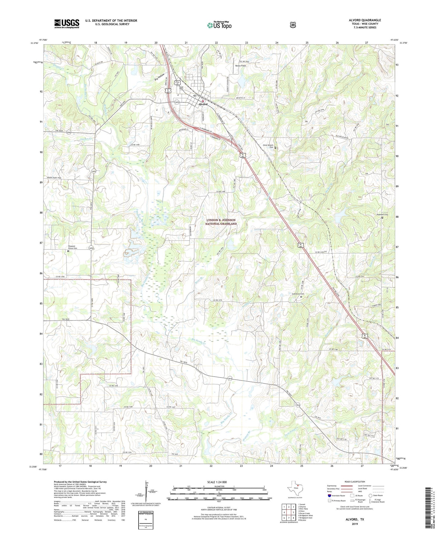
2019 topographic map quadrangle Alvord in the state of Texas. Scale: 1:24000. Based on the newly updated USGS 7.5' US Topo map series, this map is in the following counties: Wise. The map contains contour data, water features, and other items you are used to seeing on USGS maps, but also has updated roads and other features. This is the next generation of topographic maps. Printed on high-quality waterproof paper with UV fade-resistant inks.
Quads adjacent to this one:
West: Chico
Northwest: Sunset
North: Smyrna
Northeast: New Harp
East: Pecan Creek
Southeast: Decatur
South: Bridgeport East
Southwest: Bridgeport West
Contains the following named places: Alvord, Alvord Post Office, Alvord Southeast Bryson Oil Field, Alvord Volunteer Fire Department, Boonsville Oil Field, Briar Branch, Briar Branch Cemetery, Brushy Creek, Caughlin Oil Field, Chicken Creek, Church of Christ, Dry Hollow, First Baptist Church, Hopewell Cemetery, Hopewell Church, Jonestown Cemetery, Lone Star Church, Lyndon B Johnson National Grassland, Lyndon B Johnson National Grasslands Trail, Mount Zion Church, Mudhole Branch, Pleasant Grove Cemetery, Pleasant View Church, Pringle Creek, Sandy Creek, Spectre Field, Thomas Cemetery, Town of Alvord, Twin Pond Creek, Vance Field, Walker Branch, Zion Valley Cumberland Church, ZIP Code: 76225