MyTopo
Dickenson Ranch Texas US Topo Map
Couldn't load pickup availability
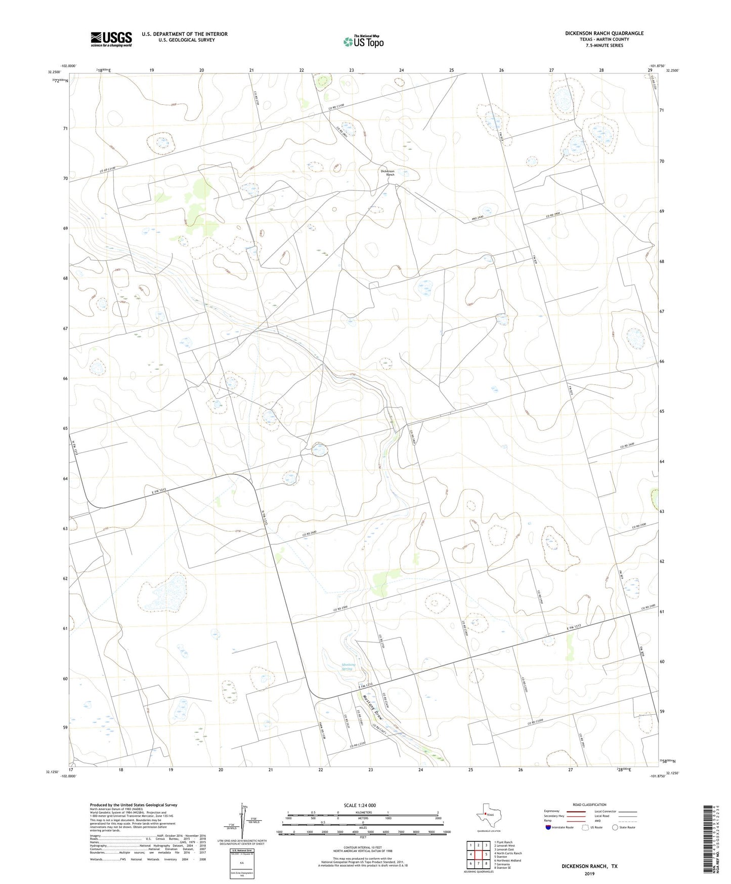
2019 topographic map quadrangle Dickenson Ranch in the state of Texas. Scale: 1:24000. Based on the newly updated USGS 7.5' US Topo map series, this map is in the following counties: Martin. The map contains contour data, water features, and other items you are used to seeing on USGS maps, but also has updated roads and other features. This is the next generation of topographic maps. Printed on high-quality waterproof paper with UV fade-resistant inks.
Quads adjacent to this one:
West: North Curtis Ranch
Northwest: Flynt Ranch
North: Lenorah West
Northeast: Lenorah East
East: Stanton
Southeast: Stanton SE
South: Germania
Southwest: Northeast Midland
Contains the following named places: Borrow Pit Windmill, Courtney, Dickenson Ranch, Doggie Windmill, Eastside Draw Windmill, Martin County Historical Museum, Mustang Spring, Northeast Sunflower Windmill, Old Jail Museum, Rattlesnake Windmill, Rock Lake Windmill, South Windmill, Thrailkill Windmill, West Sunflower Windmill, Williams Windmill, Windmill on the Hill