MyTopo
Eunice Texas US Topo Map
Couldn't load pickup availability
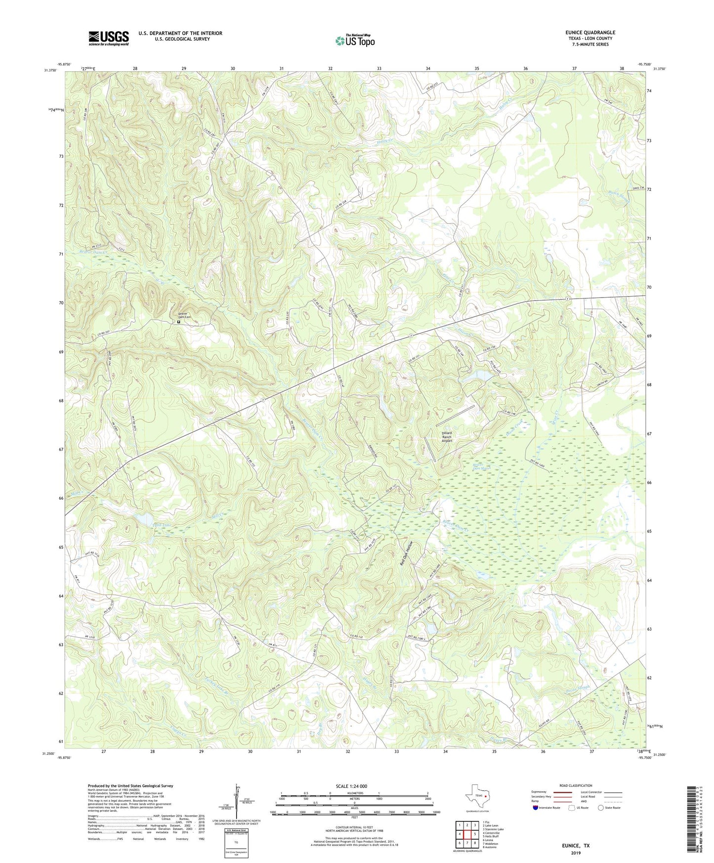
2019 topographic map quadrangle Eunice in the state of Texas. Scale: 1:24000. Based on the newly updated USGS 7.5' US Topo map series, this map is in the following counties: Leon. The map contains contour data, water features, and other items you are used to seeing on USGS maps, but also has updated roads and other features. This is the next generation of topographic maps. Printed on high-quality waterproof paper with UV fade-resistant inks.
Quads adjacent to this one:
West: Centerville
Northwest: Flo
North: Lake Leon
Northeast: Stanmire Lake
East: Halls Bluff
Southeast: Austonio
South: Middleton
Southwest: Leona
Contains the following named places: Beaver Dam Cemetery, Beaver Dam Marsh, Black Branch, Centerview, Dillard Ranch Airport, Dixon Creek, Eunice, Fort Bend County Law Library, Fort Bend County Libraries, Hayes Branch, Hopewell, Hurricane Creek, KBHT-FM (Crockett), Mill Creek, Pine Creek, Red Oak Hollow, Tubb Lake, Tubb Lake Dam, Victory Church, ZIP Code: 75833