MyTopo
Golden Texas US Topo Map
Couldn't load pickup availability
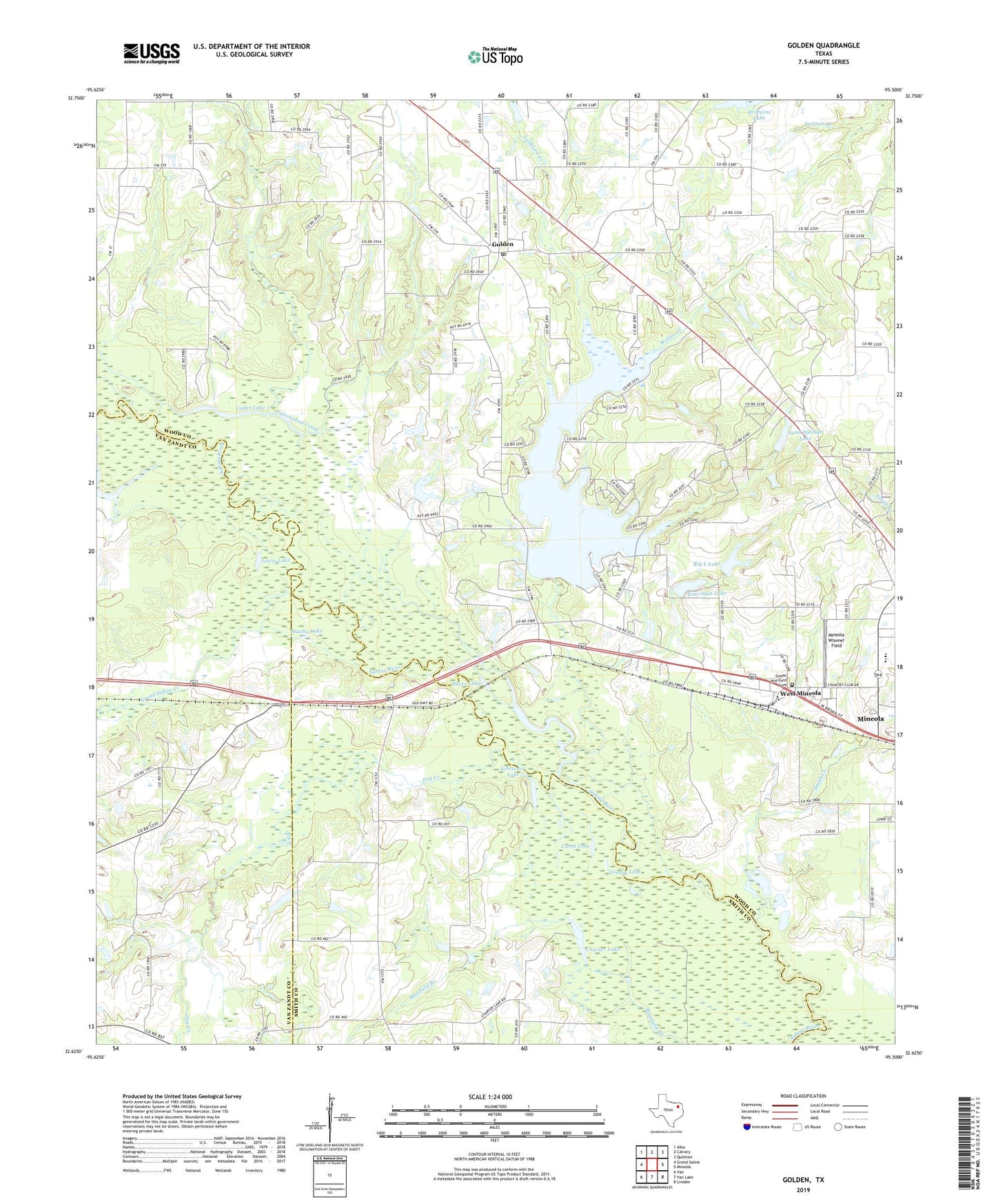
2019 topographic map quadrangle Golden in the state of Texas. Scale: 1:24000. Based on the newly updated USGS 7.5' US Topo map series, this map is in the following counties: Wood, Smith, Van Zandt. The map contains contour data, water features, and other items you are used to seeing on USGS maps, but also has updated roads and other features. This is the next generation of topographic maps. Printed on high-quality waterproof paper with UV fade-resistant inks.
Quads adjacent to this one:
West: Grand Saline
Northwest: Alba
North: Calvary
Northeast: Quitman
East: Mineola
Southeast: Lindale
South: Van Lake
Southwest: Van
Contains the following named places: Ben, Big L Lake, Big L Lake Dam, Brittains Lake, Brushy Lake, Butler Lake, Camp Lake, Cedar Lake, Charter Lake, Clear Lake, Cottonwood Church, Cottonwood Creek, Dale Crest Church, Dry Creek, Frank Branch Library, Golden, Golden Post Office, Grand Saline Creek, Grassy Lake, Green and Ford Cemetery, Henington - Alief Branch Library, Hillendahl Branch Library, Kendall Branch Library, Keys Creek, Kim Juan Lake Dam, Kim-Juan Lake, Lake Holbrook, Lankford Creek, Lewis Lake, Mineola Elementary School, Mineola High School, Mineola Wisener Field, Neil Lake, Nolan-Edwards Oil Field, Northwest Branch Library, Plunk Lake, Plunk Lake Dam, Providence School, Sand Springs Church, Sand Springs Lake, Schrivnor Lake, Silver Lake, Smith Creek, Wellon Creek, West Mineola, Wood County Dam Number 2