MyTopo
Iron Bridge Dam Texas US Topo Map
Couldn't load pickup availability
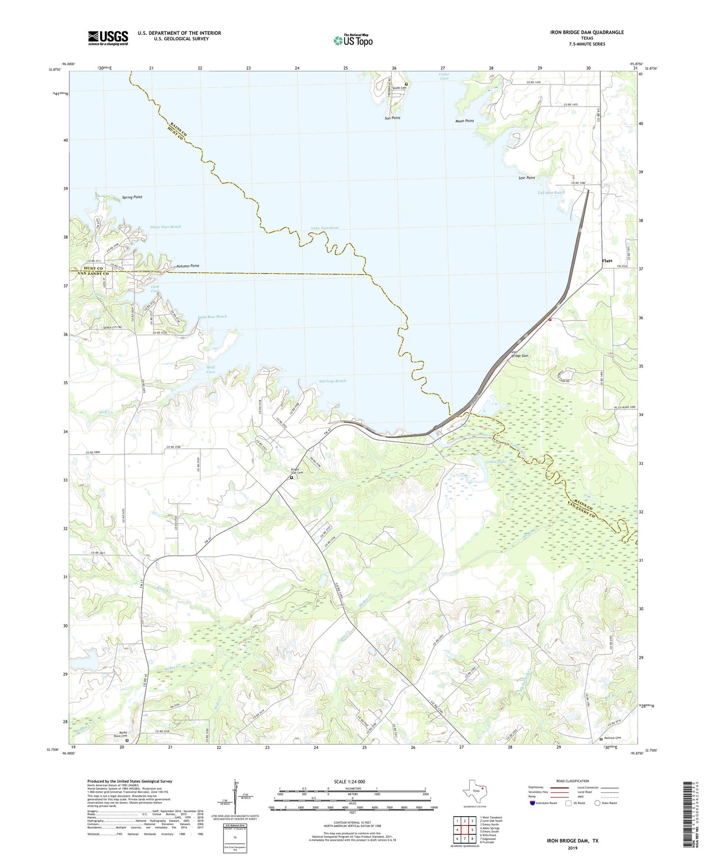
2019 topographic map quadrangle Iron Bridge Dam in the state of Texas. Scale: 1:24000. Based on the newly updated USGS 7.5' US Topo map series, this map is in the following counties: Van Zandt, Rains, Hunt. The map contains contour data, water features, and other items you are used to seeing on USGS maps, but also has updated roads and other features. This is the next generation of topographic maps. Printed on high-quality waterproof paper with UV fade-resistant inks.
Quads adjacent to this one:
West: Ables Springs
Northwest: West Tawakoni
North: Lone Oak South
Northeast: Emory North
East: Emory South
Southeast: Fruitvale
South: Edgewood
Southwest: Wills Point
Contains the following named places: Autumn Point, Bright Star Cemetery, Bright Star Church, Caney Creek, Cedar Creek, Chapel of the Lake, Clarks Chapel, Clifton, Flats, Goose Lake, Gum Cove, Iron Bridge Dam, Koen Creek, Lake Tawakoni State Park, Lake Tawakoni State Park Trail, Long Bow Reach, Magby Creek, McBee Creek, McEnturff Creek, Moon Point, Morince Cemetery, Rocky Point Cemetery, Shook Cemetery, Southwest Rains Volunteer Fire Department, Spring Point, Star Point, Sun Point, Tall Man Reach, Van Zandt County Park, Warloup Reach, White Deer Reach, Wills Creek, Wolf Cove, Wolf Creek