MyTopo
Leona Texas US Topo Map
Couldn't load pickup availability
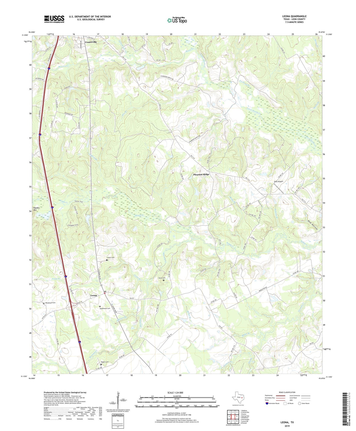
2019 topographic map quadrangle Leona in the state of Texas. Scale: 1:24000. Based on the newly updated USGS 7.5' US Topo map series, this map is in the following counties: Leon. The map contains contour data, water features, and other items you are used to seeing on USGS maps, but also has updated roads and other features. This is the next generation of topographic maps. Printed on high-quality waterproof paper with UV fade-resistant inks.
Quads adjacent to this one:
West: Spring Seat
Northwest: Robbins
North: Centerville
Northeast: Eunice
East: Middleton
Southeast: Elwood
South: Leona SW
Southwest: Normangee
Contains the following named places: Adkisson Branch, Beaver Creek, Butler Branch, Cedar Creek, City of Leona, Culton Cemetery, Durst Cemetery, Forehand Branch, Fort Boggy State Park, Fort Boggy State Park Trail, Hillery Chapel, Langford Branch, Leona, Leona Branch, Leona Post Office, Leona Volunteer Fire Department, Little Beaver Creek, Makamsom Cemetery, Mount Zion Church, Mustang Creek, Pine Branch, Pine Top Church, Pleasant Ridge, Pleasant Ridge Church, Pole Bridge Branch, Robeson Branch, Rocky Branch, Rogers Cemetery, Spring Branch, Twomile Church, Washington Perkins School, Woodward Cemetery, Zoch Airport, ZIP Code: 75850