MyTopo
Milano Texas US Topo Map
Couldn't load pickup availability
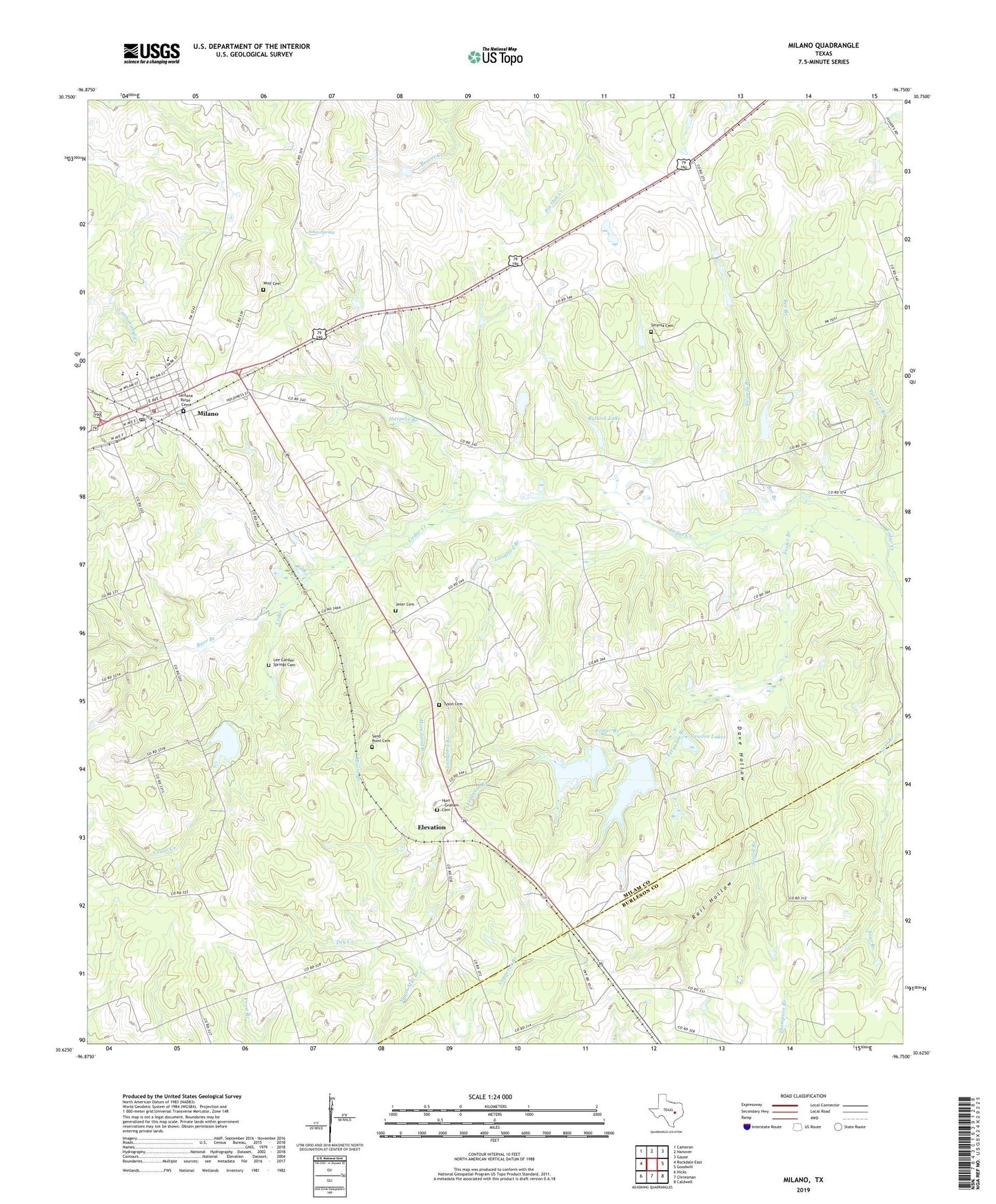
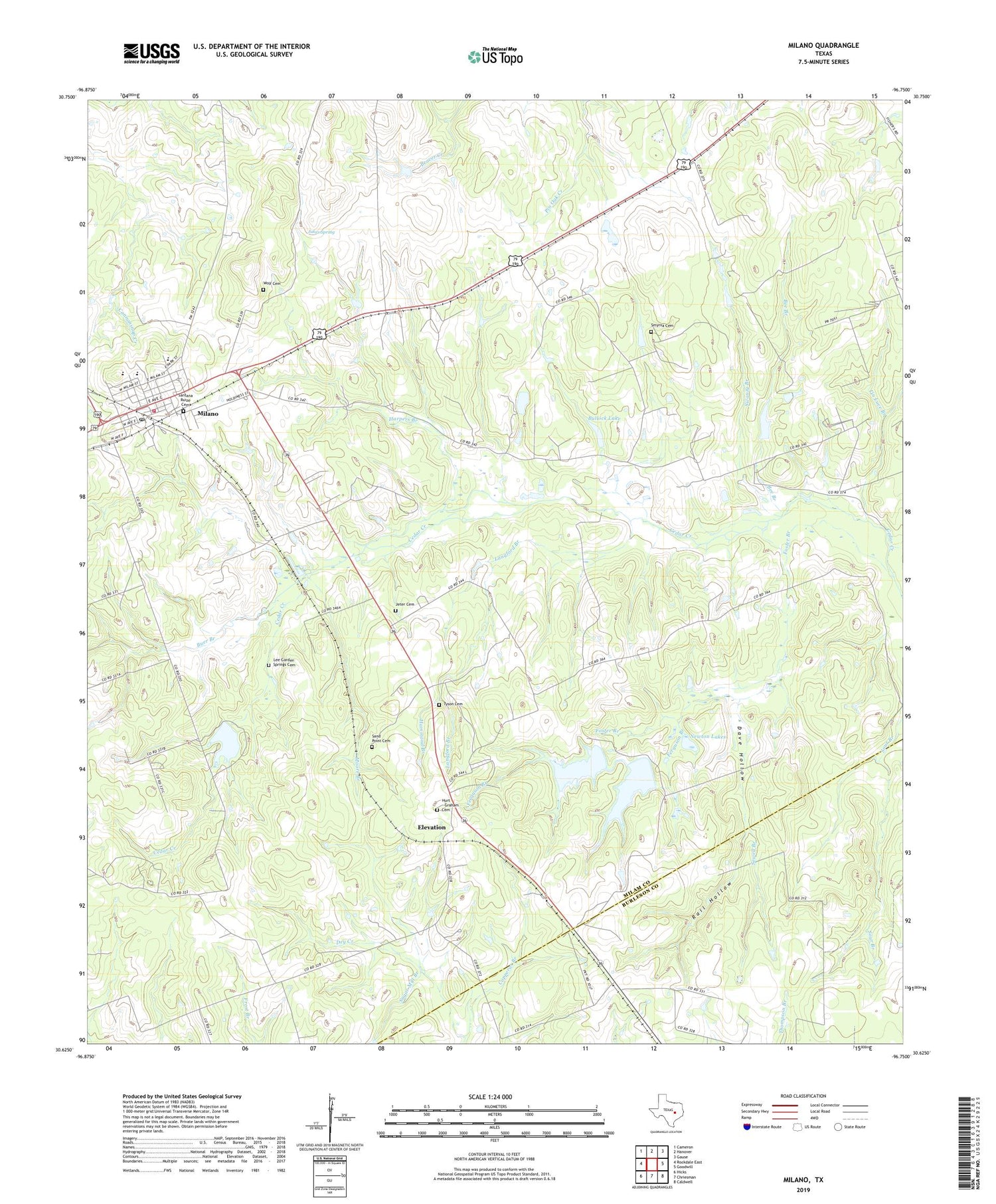
2019 topographic map quadrangle Milano in the state of Texas. Scale: 1:24000. Based on the newly updated USGS 7.5' US Topo map series, this map is in the following counties: Milam, Burleson. The map contains contour data, water features, and other items you are used to seeing on USGS maps, but also has updated roads and other features. This is the next generation of topographic maps. Printed on high-quality waterproof paper with UV fade-resistant inks.
Quads adjacent to this one:
West: Rockdale East
Northwest: Cameron
North: Hanover
Northeast: Gause
East: Goodwill
Southeast: Caldwell
South: Chriesman
Southwest: Hicks
Contains the following named places: American Medical Response Ambulance Service Station 3, Bee Branch, Buer Branch, Bullock Lake, Bullock Lake Dam, Cedar Park, City of Milano, Copperas Branch, Dave Hollow, Devils Hollow, Elevation, Ferguson Branch, Foster Branch, Friendship Church, Gause-Milano Division, Hammond Branch, Harpers Branch, Hurt - Graham Cemetery, Jakes Spring, Jeter Cemetery, Langford Branch, Lee Garden Springs Cemetery, Lin Luce Branch, Milano, Milano City Hall, Milano Post Office, Milano Volunteer Fire Department, Moore Branch, Newton Lake Number 1, Newton Lake Number 1 Dam, Newton Lake Number 2, Newton Lake Number 2 Dam, Newton Lakes, Rail Hollow, Sand Grove Church, Sand Point Cemetery, Santana Ruiz Cemeterio, Sewell Branch, Smyrna Cemetery, Sugar Mill Branch, Swanzy Branch, Texas No Name Number 50 Dam, Texas No Name Number 50 Lake, Tyson Cemetery, Wolf Cemetery, Zalmanek Lake, Zalmanek Lake Dam, ZIP Code: 76556