MyTopo
Stanmire Lake Texas US Topo Map
Couldn't load pickup availability
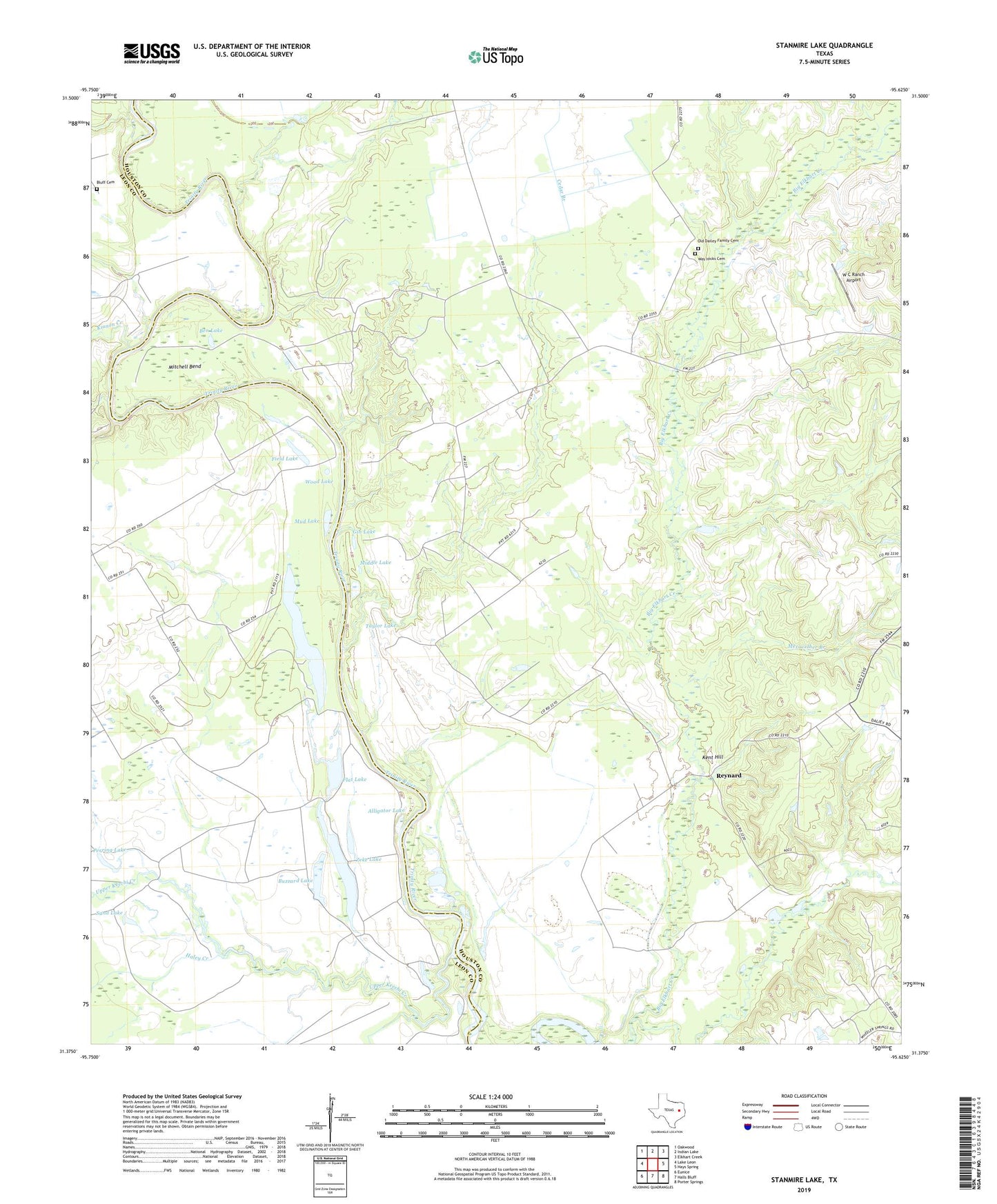
2019 topographic map quadrangle Stanmire Lake in the state of Texas. Scale: 1:24000. Based on the newly updated USGS 7.5' US Topo map series, this map is in the following counties: Houston, Leon. The map contains contour data, water features, and other items you are used to seeing on USGS maps, but also has updated roads and other features. This is the next generation of topographic maps. Printed on high-quality waterproof paper with UV fade-resistant inks.
Quads adjacent to this one:
West: Lake Leon
Northwest: Oakwood
North: Indian Lake
Northeast: Elkhart Creek
East: Hays Spring
Southeast: Porter Springs
South: Halls Bluff
Southwest: Eunice
Contains the following named places: Alligator Lake, Ben Lake, Bluff Cemetery, Buzzard Lake, Cedar Branch, Cedar Branch Church, Chiles Branch, Clear Lake, Field Lake, Flat Lake, Gin Lake, Greater New Hope Church, Haley Creek, Kent Hill, Kinnon Creek, Little Elkhart Creek, Meriwether Branch, Middle Lake, Mitchell Bend, Mud Lake, Murchison Branch, Navarro Crossing Oil Field, Old Dailey Family Cemetery, Perring Lake, Reynard, Sand Flat School, Sand Lake, Shiloh Church, Stanmire Lake, Taylor Lake, Upper Keechi Creek, W C Ranch Airport, Wes Hicks Cemetery, Wheeler Springs, Wood Lake, Zeke Lake