MyTopo
Weatherford North Texas US Topo Map
Couldn't load pickup availability
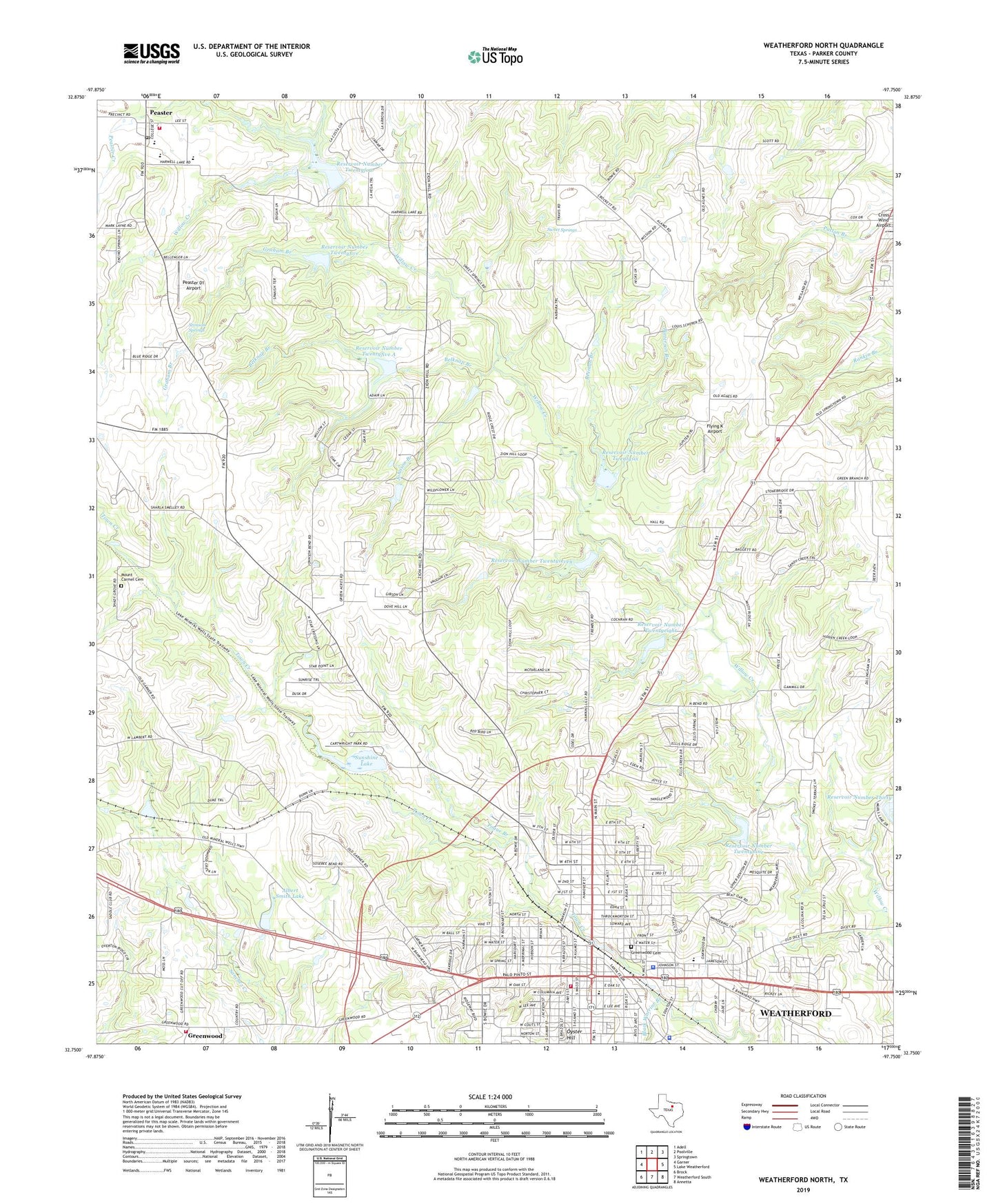
2019 topographic map quadrangle Weatherford North in the state of Texas. Scale: 1:24000. Based on the newly updated USGS 7.5' US Topo map series, this map is in the following counties: Parker. The map contains contour data, water features, and other items you are used to seeing on USGS maps, but also has updated roads and other features. This is the next generation of topographic maps. Printed on high-quality waterproof paper with UV fade-resistant inks.
Quads adjacent to this one:
West: Garner
Northwest: Adell
North: Poolville
Northeast: Springtown
East: Lake Weatherford
Southeast: Annetta
South: Weatherford South
Southwest: Brock
Contains the following named places: Albert Smith Lake, Albert Smith Lake Dam, Ball Saint Baptist Church, Beeman Branch, Belknap Branch, Bethel Baptist Church, Black Warrior Branch, Bowie Elementary School, Bowie School, Calvary Church, Calvary United Methodist Church, Central Community Volunteer Fire Department Station 2, Chandor Gardens, Cherry Park, Church of Christ, Church of Christ - South Main, Church of Christ - Spanish Ministries, City Greenwood Cemetery, City of Weatherford, Crockett Elementary School, Crockett School, Eureka Baptist Church, First Baptist Church of Weatherford, First Free Will Baptist Church, Flying K Airport, Graham Branch, Greenwood, Greenwood Baptist Church, Greenwood Community Cemetery, Greenwood Rural Volunteer Fire Department, Hilltop Baptist Church, Holder Branch, Johnson Branch, KYQX-FM (Weatherford), KZEE-AM (Weatherford), McGratton Park, Moreau Public Library, Mount Carmel Cemetery, Mount Zion Baptist Church, New Hope Baptist Church, North Side Baptist Church, North Side Consolidated School, Oyster Hill, Parker County, Parker County Constable's Office Precinct 2, Parker County Jail, Parker County Museum and Trading Post, Parker County Sheriff's Office, Patterson Branch, Peaster, Peaster 01 Airport, Peaster Creek, Peaster Post Office, Peaster Volunteer Fire Department, Pogue Branch, Providence Reformed Episcopal Church, Reservoir Number Thirty, Reservoir Number Twentyeight, Reservoir Number Twentyfive, Reservoir Number Twentyfive A, Reservoir Number Twentyfour, Reservoir Number Twentynine, Reservoir Number Twentyseven, Reservoir Number Twentysix, Rock Springs Cemetery, Seventh Day Adventist Church, Shady Gove Cemetery, Shady Grove Church, Soil Conservation Service Site 24 Dam, Soil Conservation Service Site 24 Reservoir, Soil Conservation Service Site 25 Dam, Soil Conservation Service Site 25a Dam, Soil Conservation Service Site 25a Reservoir, Soil Conservation Service Site 26 Dam, Soil Conservation Service Site 27 Dam, Soil Conservation Service Site 28 Dam, Soil Conservation Service Site 29 Dam, Soil Conservation Service Site 29 Reservoir, Soil Conservation Service Site 30 Dam, Stanley School, Stimson Springs, Sunshine Lake, Sunshine Lake Dam, Sweet Springs, Town of Peaster, Travis Elementary School, Travis School, Victory Baptist Church, Weatherford, Weatherford City Hall, Weatherford College, Weatherford Downtown Historic District, Weatherford Fire Department Station 1, Weatherford Police Department, Weiland Church, Zion Hill Cemetery, Zion Hill Church, ZIP Code: 76086