MyTopo
Winona Texas US Topo Map
Couldn't load pickup availability
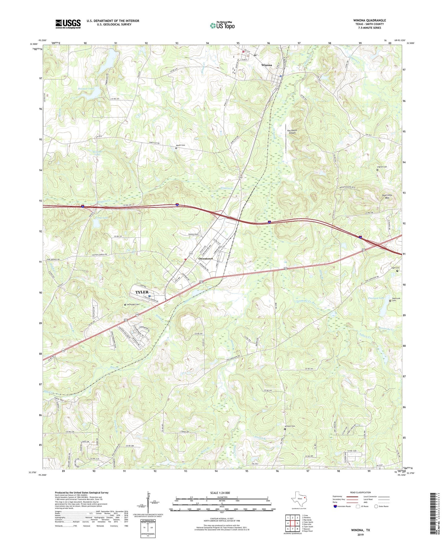
2019 topographic map quadrangle Winona in the state of Texas. Scale: 1:24000. Based on the newly updated USGS 7.5' US Topo map series, this map is in the following counties: Smith. The map contains contour data, water features, and other items you are used to seeing on USGS maps, but also has updated roads and other features. This is the next generation of topographic maps. Printed on high-quality waterproof paper with UV fade-resistant inks.
Quads adjacent to this one:
West: Tyler North
Northwest: Crow
North: Hawkins
Northeast: Big Sandy
East: Starrville
Southeast: Hope Pond
South: Bascom
Southwest: Tyler South
Contains the following named places: Alden Branch, Antioch Branch, Antioch Cemetery, Atascocita Branch Library, Auburn Creek, Bracewell Branch Library, Center Church, Coldhill Church, Cole Hill Church, Driscoll Lake, Fivemile Branch, Greys Lake, Greys Lake Dam, Harris Creek Baptist Church, Harris Creek Church, Hebron Church, Henrys Church, High Cemetery, Higher Hope Fellowship Church, Ingram Cemetery, Jackson Elementary School, Jones Branch, Kay Ranch Airport, KTYL-FM (Tyler), Liberty Church, Loves Branch, Marsh Cemetery, McDougal Cemetery, New Zion Church, Owentown, Pinedale Dam, Pinedale Lake, Pineland Lake, Pineland Lake Dam, Pleasant Grove Church, Ray Creek, Saint Viola Church, Seastrunk Cemetery, Smith County Constable's Office Precinct 4, Starrville Mountain, Starrville Rodeo Ground, Sunstroke Creek, Timber Lake, Timber Lake Dam, Town of Winona, Triumph Church, University of Texas Health Science Center at Tyler, Walsh Creek, Wiggins Creek, Winona, Winona Elementary School, Winona High School, Winona Middle School, Winona Police Department, Winona Post Office, Winona Volunteer Fire Department Station 1, Winona Volunteer Fire Department Station 2, ZIP Code: 75708