MyTopo
Billies Mountain Utah US Topo Map
Couldn't load pickup availability
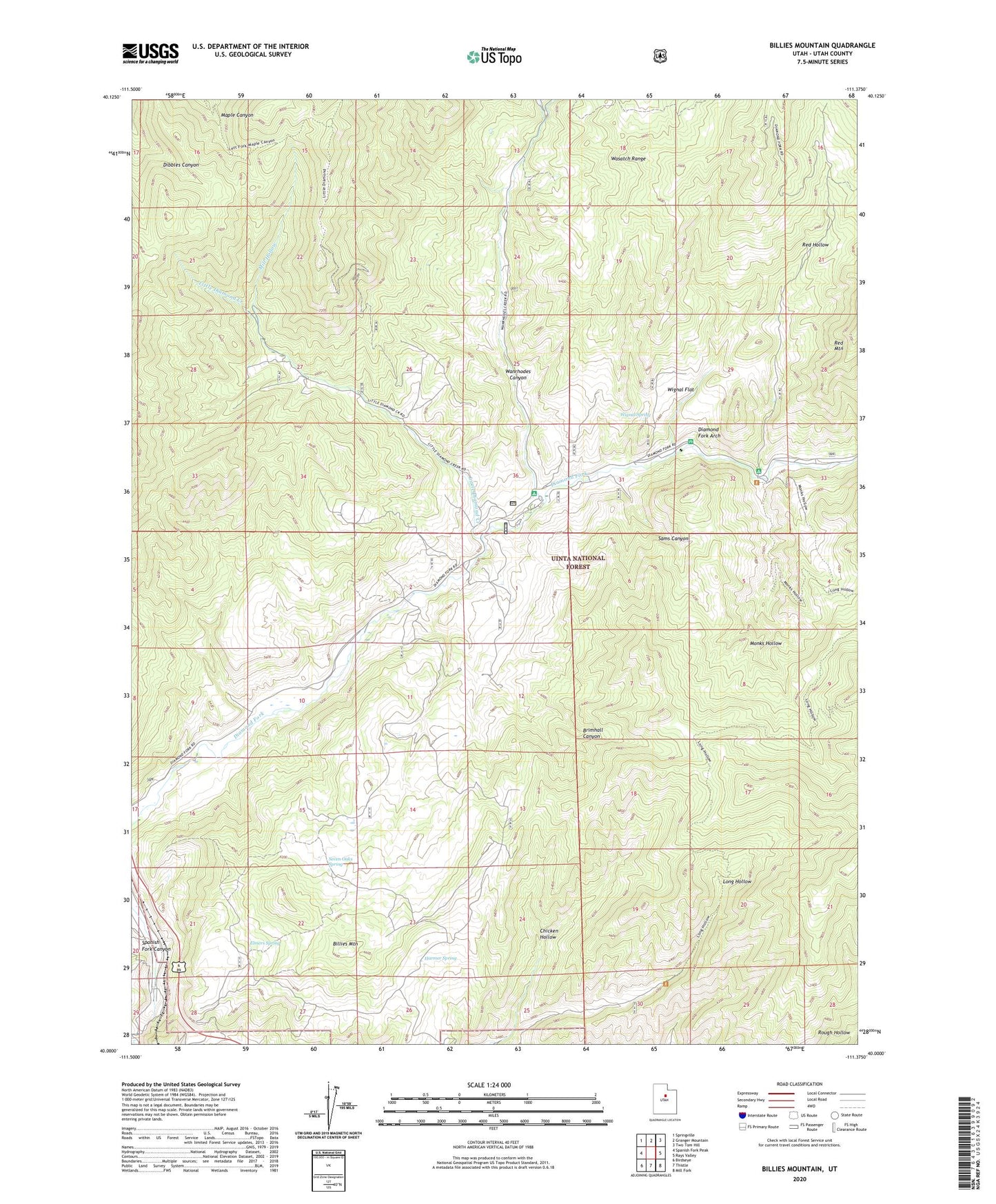
2020 topographic map quadrangle Billies Mountain in the state of Utah. Scale: 1:24000. Based on the newly updated USGS 7.5' US Topo map series, this map is in the following counties: Utah. The map contains contour data, water features, and other items you are used to seeing on USGS maps, but also has updated roads and other features. This is the next generation of topographic maps. Printed on high-quality waterproof paper with UV fade-resistant inks.
Quads adjacent to this one:
West: Spanish Fork Peak
Northwest: Springville
North: Granger Mountain
Northeast: Two Tom Hill
East: Rays Valley
Southeast: Mill Fork
South: Thistle
Southwest: Birdseye
Contains the following named places: Billies Mountain, Brimhall Canyon, Diamond Battle Historical Monument, Diamond Campground, Diamond Fork Arch, Diamond Fork Youth Forest, Elmers Spring, Harmer Spring, Little Diamond Creek, Mill Hollow, Monks Hollow, Palmyra Campground, Patrick Place, Red Hollow, Sams Canyon, Seven Oaks Spring, Wanrhodes Canyon, Wignal Flat, Wignal Spring