MyTopo
Bridger Point Utah US Topo Map
Couldn't load pickup availability
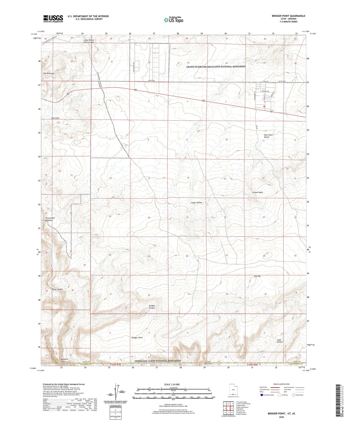
2020 topographic map quadrangle Bridger Point in the state of Utah. Scale: 1:24000. Based on the newly updated USGS 7.5' US Topo map series, this map is in the following counties: Kane, Coconino. The map contains contour data, water features, and other items you are used to seeing on USGS maps, but also has updated roads and other features. This is the next generation of topographic maps. Printed on high-quality waterproof paper with UV fade-resistant inks.
Quads adjacent to this one:
West: West Clark Bench
Northwest: Fivemile Valley
North: Lower Coyote Spring
Northeast: Nipple Butte
East: Big Water
Southeast: Water Pockets
South: Wrather Arch
Southwest: Poverty Flat
Contains the following named places: Bridger Canyon, Bridger Point, Buckskin Gulch, Chitum Wash, Church Wells Fire Department, East Clark Bench, Flat Top, Picturesque Windows, The Rimrocks