
MyTopo
Devils Slide Utah US Topo Map
Couldn't load pickup availability
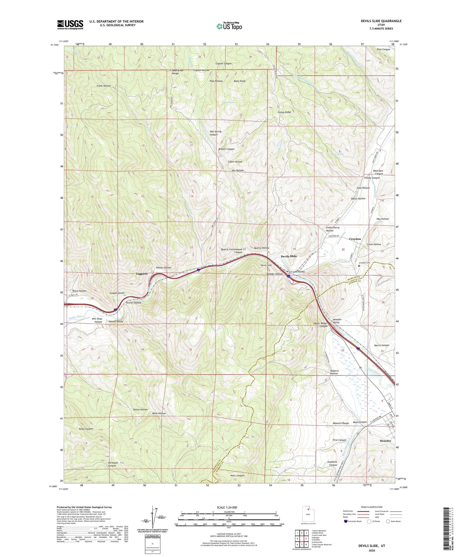
2020 topographic map quadrangle Devils Slide in the state of Utah. Scale: 1:24000. Based on the newly updated USGS 7.5' US Topo map series, this map is in the following counties: Morgan, Summit. The map contains contour data, water features, and other items you are used to seeing on USGS maps, but also has updated roads and other features. This is the next generation of topographic maps. Printed on high-quality waterproof paper with UV fade-resistant inks.
Quads adjacent to this one:
West: Morgan
Northwest: Durst Mountain
North: Bybee Knoll
Northeast: Lost Creek Dam
East: Henefer
Southeast: Coalville
South: East Canyon Reservoir
Southwest: Porterville
Contains the following named places: Big Cottonwood Creek, Big Fork, Bolly Knob, Branch Canyon, Cabin Hollow, Chokecherry Hollow, Coal Hollow, Cooper Gulch, Coyote Canyon, Coyote Hollow, Croydon, Croydon Cemetery, Devils Slide, Dry Creek, Dry Fork, Dry Hollow, First Canyon, Folley Canyon, Folley Spring, Frank Hollow, Harris Canyon, Hay Hollow, Henefer Valley, Little Cottonwood Creek, Little Hollow, Lost Creek, Lost Valley, Main Canyon, Main Canyon Creek, Mine Hollow, Morgan County, Oak Spring, Oak Spring Canyon, Phil Shop Hollow, Pipe Hollow, Powder Hollow, Quarry Cottonwood Canyon, Quarry Cottonwood Creek, Quarry Hollow, Right Fork Dry Creek, Roberts Hollow, Sharps Hollow, Shells Hollow, Stephens Canyon, Taggarts, Tunnel Hollow, Wolf Den Canyon, Yence Hollow


