MyTopo
Fox Lake Utah US Topo Map
Couldn't load pickup availability
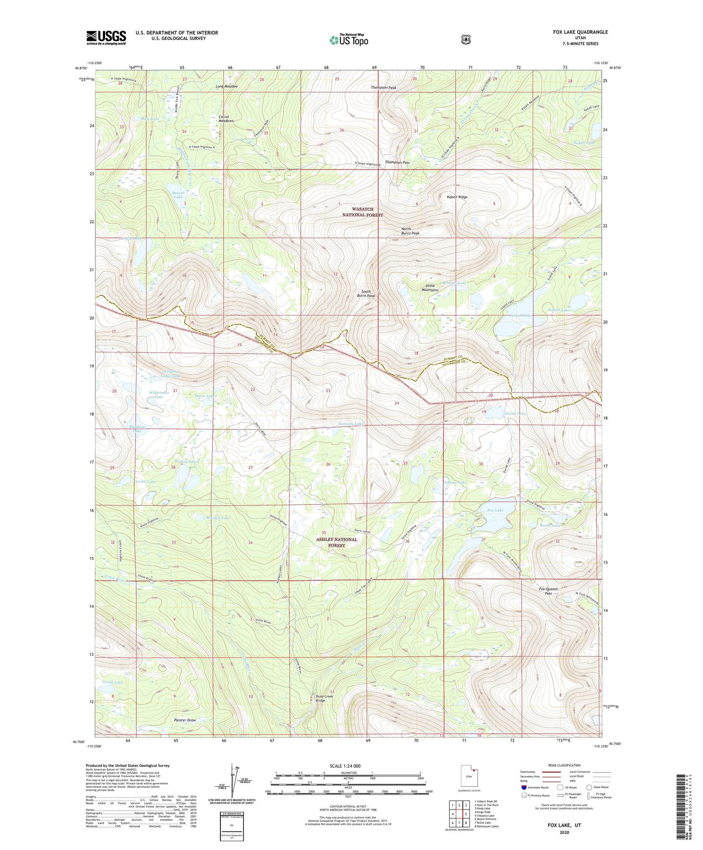
2020 topographic map quadrangle Fox Lake in the state of Utah. Scale: 1:24000. Based on the newly updated USGS 7.5' US Topo map series, this map is in the following counties: Duchesne, Summit. The map contains contour data, water features, and other items you are used to seeing on USGS maps, but also has updated roads and other features. This is the next generation of topographic maps. Printed on high-quality waterproof paper with UV fade-resistant inks.
Quads adjacent to this one:
West: Kings Peak
Northwest: Gilbert Peak NE
North: Hole In The Rock
Northeast: Hoop Lake
East: Chepeta Lake
Southeast: Rasmussen Lakes
South: Bollie Lake
Southwest: Mount Emmons
Contains the following named places: Beaver Lake, Bennion Lake, Bowden Lake, Brook Lake, Coffin Lake, Corral Meadows, Craig Lake, Crescent Lake, Crescent Lake Dam, Davis Lakes, Dime Lake, Dine Lake, Divide Lake, Fox Lake, Fox Lake Dam, Fox Queant Pass, Gilbert Creek, Island Lake, Island Lake Dam, Kabell Lake, Kabell Ridge, Kidney Lakes, Long Meadow, North Burro Peak, North Fork Park, Rainbow Lake, Round Lake, Samuels Lake, Shale Creek, Shale Creek Bridge, Shale Dugway, South Burro Peak, Thompson Pass, Thompson Peak, Uinta Canyon Forest Service Station, Verlie Lake, Weeping Ledge Lake, Wilderness Lake