MyTopo
Grantsville Utah US Topo Map
Couldn't load pickup availability
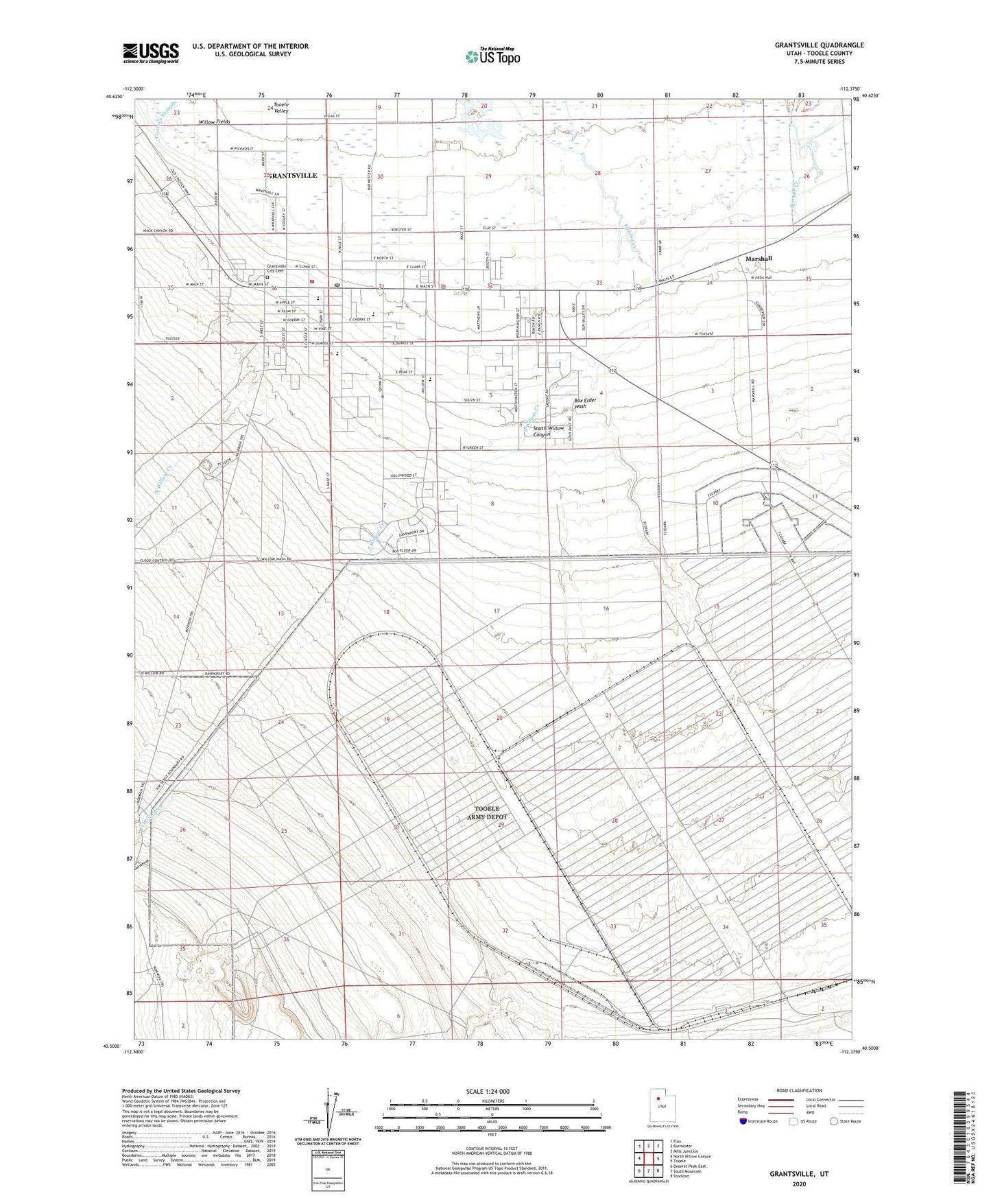
2020 topographic map quadrangle Grantsville in the state of Utah. Scale: 1:24000. Based on the newly updated USGS 7.5' US Topo map series, this map is in the following counties: Tooele. The map contains contour data, water features, and other items you are used to seeing on USGS maps, but also has updated roads and other features. This is the next generation of topographic maps. Printed on high-quality waterproof paper with UV fade-resistant inks.
Quads adjacent to this one:
West: North Willow Canyon
Northwest: Flux
North: Burmester
Northeast: Mills Junction
East: Tooele
Southeast: Stockton
South: South Mountain
Southwest: Deseret Peak East
Contains the following named places: Blue Lakes, Box Elder Wash, City of Grantsville, First Baptist Church, Grantsville, Grantsville City Cemetery, Grantsville Elementary School, Grantsville Fire Department, Grantsville Fort Historic Marker, Grantsville High School, Grantsville Junior High School, Grantsville Police Department, Grantsville Post Office, Marshall, Mountain West Ambulance Grantsville, North Willow Creek, South Willow Canyon, South Willow Creek, The Church of Jesus Christ of Latter Day Saints, Tooele Army Depot