MyTopo
Hatch Utah US Topo Map
Couldn't load pickup availability
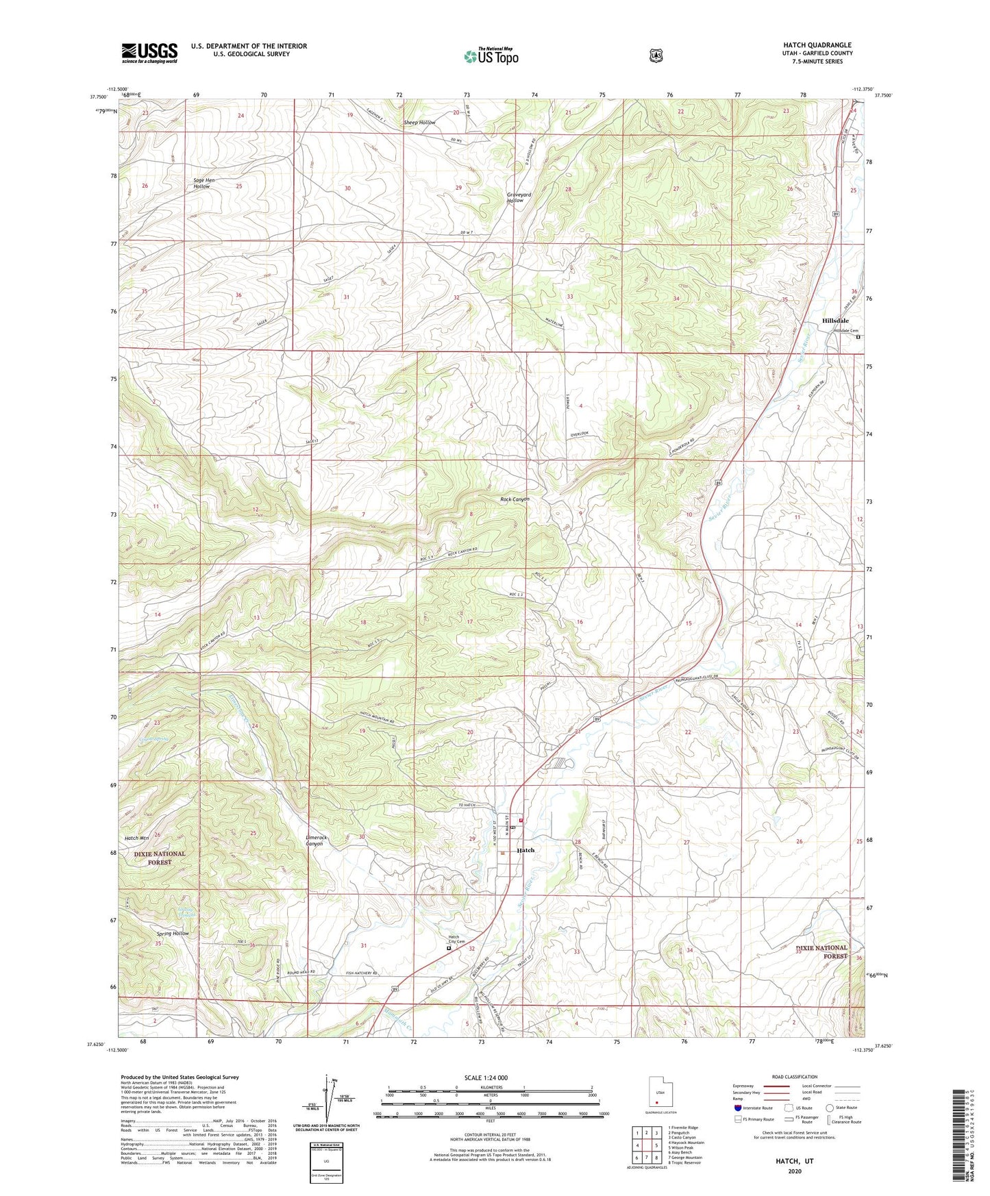
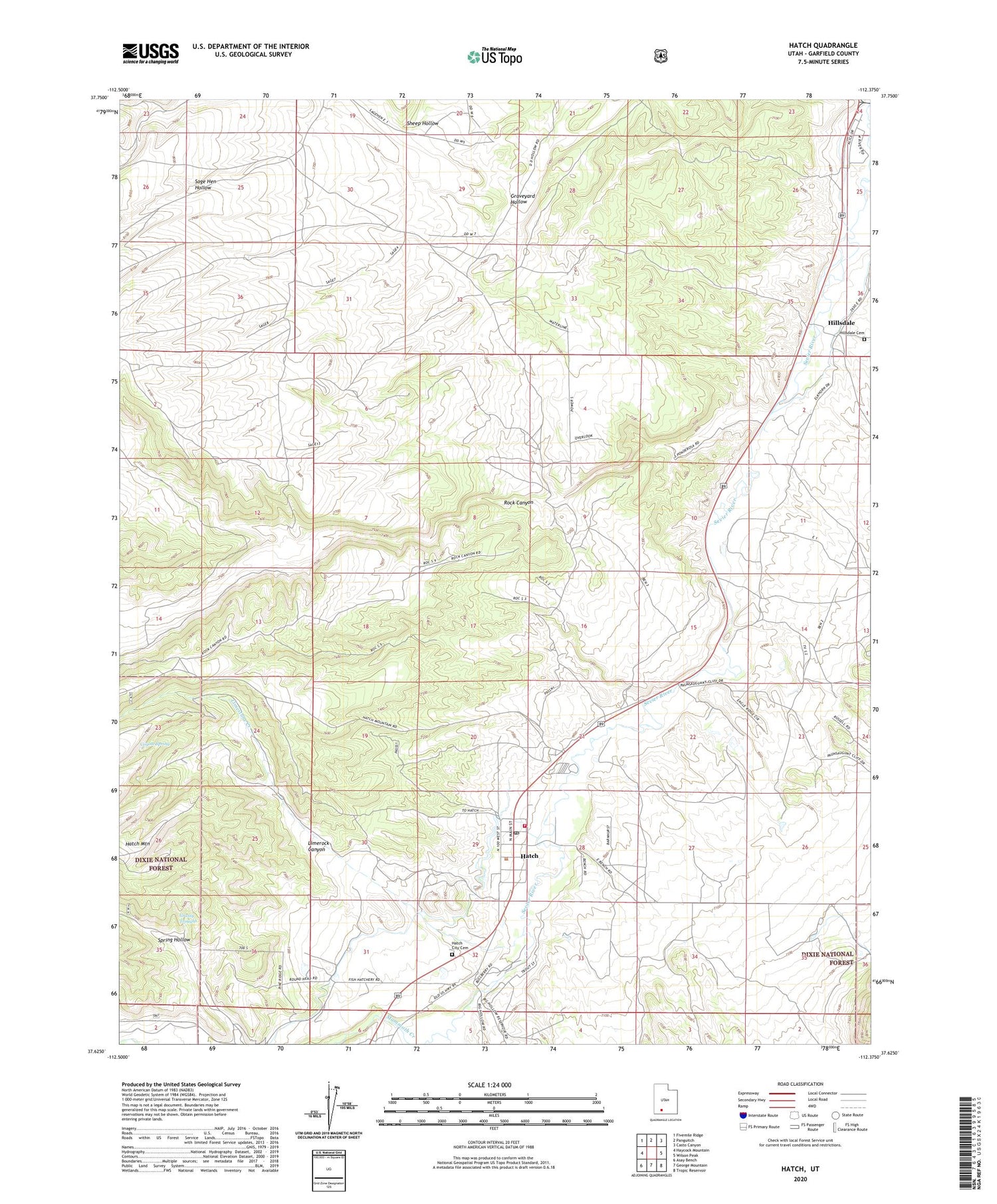
2020 topographic map quadrangle Hatch in the state of Utah. Scale: 1:24000. Based on the newly updated USGS 7.5' US Topo map series, this map is in the following counties: Garfield. The map contains contour data, water features, and other items you are used to seeing on USGS maps, but also has updated roads and other features. This is the next generation of topographic maps. Printed on high-quality waterproof paper with UV fade-resistant inks.
Quads adjacent to this one:
West: Haycock Mountain
Northwest: Fivemile Ridge
North: Panguitch
Northeast: Casto Canyon
East: Wilson Peak
Southeast: Tropic Reservoir
South: George Mountain
Southwest: Asay Bench
Contains the following named places: Coal Pit Wash, Coyote Spring, Garfield County Ambulance, Grassy Troughs, Hatch, Hatch City Cemetery, Hatch Post Office, Hatch Volunteer Fire Department, Hillsdale, Hillsdale Cemetery, Johnsonville Site, Limerock Canyon, Limestone Creek, Mammoth Creek, Mountain Ridge RV Park, Riverside Campground, Rock Canyon, Sage Hen Hollow, Spring Hollow, The Church of Jesus Christ of Latter Day Saints, Town of Hatch, ZIP Code: 84735