
MyTopo
Holden Utah US Topo Map
Couldn't load pickup availability
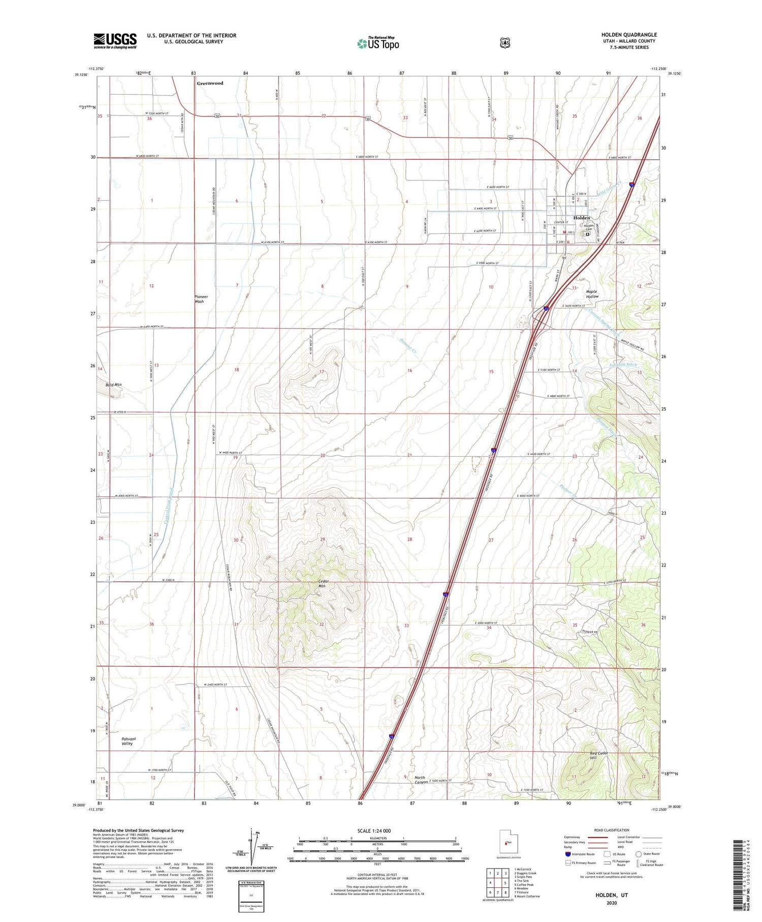
2020 topographic map quadrangle Holden in the state of Utah. Scale: 1:24000. Based on the newly updated USGS 7.5' US Topo map series, this map is in the following counties: Millard. The map contains contour data, water features, and other items you are used to seeing on USGS maps, but also has updated roads and other features. This is the next generation of topographic maps. Printed on high-quality waterproof paper with UV fade-resistant inks.
Quads adjacent to this one:
West: The Sink
Northwest: McCornick
North: Duggins Creek
Northeast: Scipio Pass
East: Coffee Peak
Southeast: Mount Catherine
South: Fillmore
Southwest: Meadow
Contains the following named places: Bennett Field Wildlife Management Area, Cedar Mountain, Circus Hollow Wildlife Management Area, Current Spring Ditch, Greenwood, Holden, Holden Cemetery, Holden Fire Department, Johnson Ditch, Maple Hollow, North Canyon, Pioneer Creek, Pioneer Ditch, Red Cedar Hill, Sage Hill, The Church of Jesus Christ of Latter Day Saints, Town of Holden, Wild Goose Creek


