MyTopo
Kanarraville Utah US Topo Map
Couldn't load pickup availability
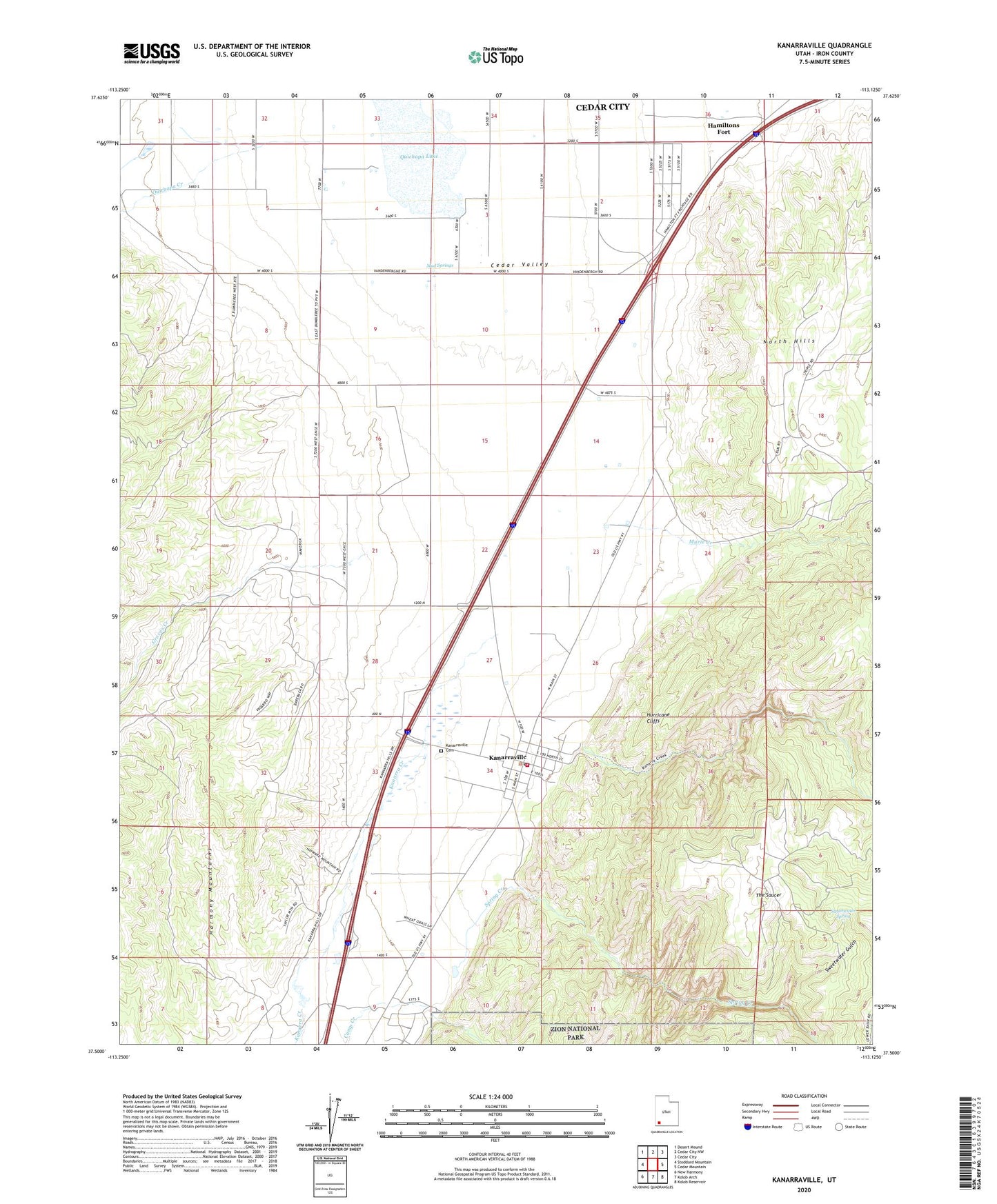
2020 topographic map quadrangle Kanarraville in the state of Utah. Scale: 1:24000. Based on the newly updated USGS 7.5' US Topo map series, this map is in the following counties: Iron. The map contains contour data, water features, and other items you are used to seeing on USGS maps, but also has updated roads and other features. This is the next generation of topographic maps. Printed on high-quality waterproof paper with UV fade-resistant inks.
Quads adjacent to this one:
West: Stoddard Mountain
Northwest: Desert Mound
North: Cedar City NW
Northeast: Cedar City
East: Cedar Mountain
Southeast: Kolob Reservoir
South: Kolob Arch
Southwest: New Harmony
Contains the following named places: Escalante Interpretive Site, Groves Creek, Hamiltons Fort, Harris Gubler Dam, Harris Gubler Reservoir, Kanarraville, Kanarraville Cemetery, Kanarraville Fire Department, Kanarraville Post Office, Mud Springs, Murie Creek, North Hills, Paiute Indian Reservation, Quichapa Creek, Spring Creek, Sweetwater Gulch, Sweetwater Spring, The Church of Jesus Christ of Latter Day Saints, The Saucer, Town of Kanarraville, ZIP Codes: 84720, 84742