MyTopo
Logan Peak Utah US Topo Map
Couldn't load pickup availability
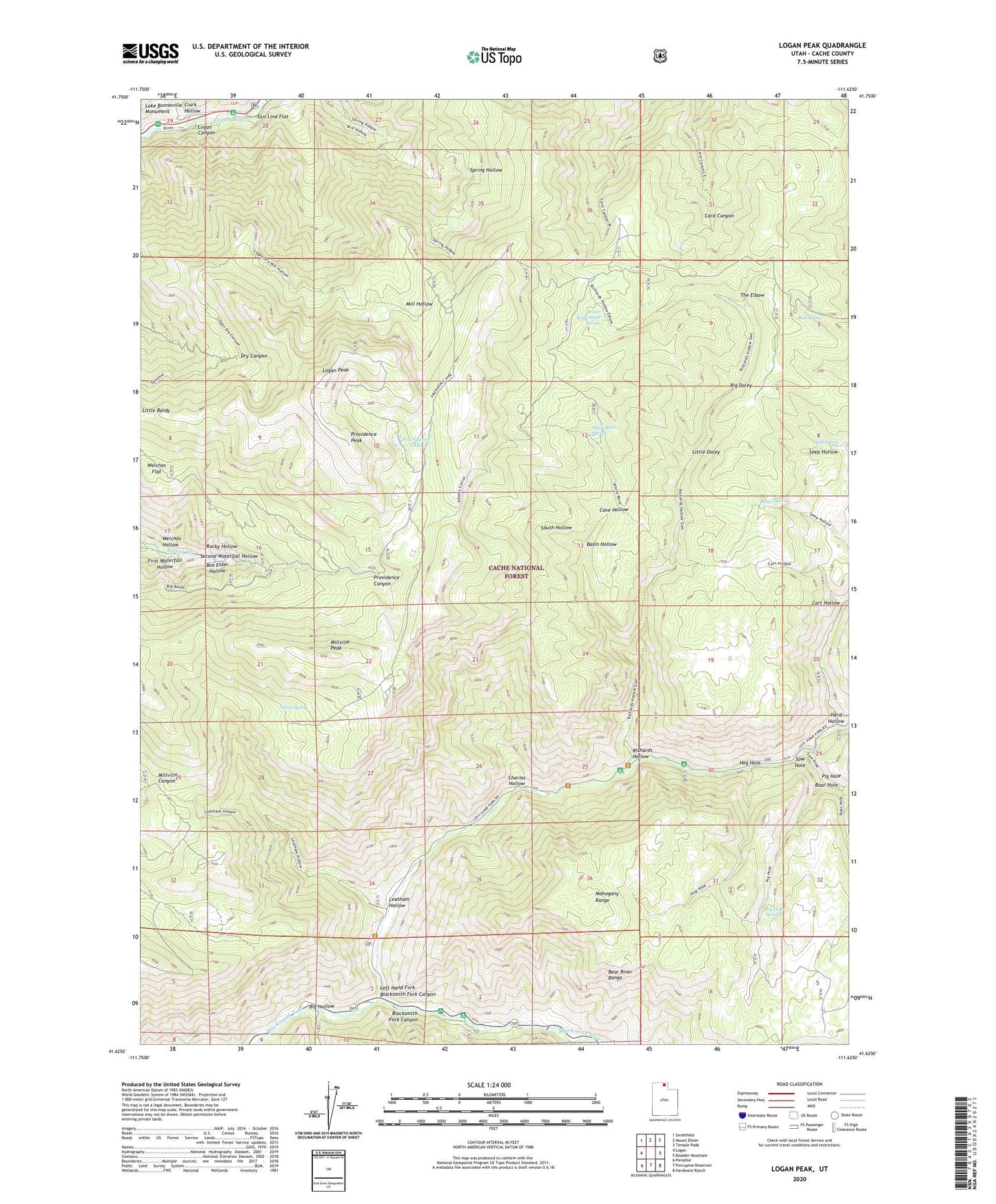
2020 topographic map quadrangle Logan Peak in the state of Utah. Scale: 1:24000. Based on the newly updated USGS 7.5' US Topo map series, this map is in the following counties: Cache. The map contains contour data, water features, and other items you are used to seeing on USGS maps, but also has updated roads and other features. This is the next generation of topographic maps. Printed on high-quality waterproof paper with UV fade-resistant inks.
Quads adjacent to this one:
West: Logan
Northwest: Smithfield
North: Mount Elmer
Northeast: Temple Peak
East: Boulder Mountain
Southeast: Hardware Ranch
South: Porcupine Reservoir
Southwest: Paradise
Contains the following named places: Adams Corral, Banjo Spring, Basin Hollow, Big Daley, Big Hollow, Blacksmith Fork Guard Station, Boar Hole, Box Elder Hollow, Box Spring, Bridger Campground, Cache County, Cache National Forest, Cart Hollow, Cave Hollow, Charles Hollow, Clark Hollow, East Cache Division, Ferry Spring, First Waterfall Hollow, Friendship Campground, Gus Lind Flat, Herd Hollow, Hog Hole, Hyrum City Park, Lake Bonneville Monument, Leatham Hollow, Left Hand Fork Blacksmith Fork Canyon, Little Daley, Logan Peak, Mahogany Range, Millville Peak, Pig Hole, Pig Hole Spring, Pioneer Campground, Providence Lake, Providence Peak, Richards Hollow, Rocky Hollow, Second Waterfall Hollow, Seep Spring, Shenoah Campground, South Hollow, Sow Hole, Spring Picnic Area, The Elbow, Upper Spring Hollow Picnic Area, Welches Flat, Welches Hollow, White Bedground Camp, White Bedground Spring, White Rock Spring