MyTopo
Marysvale Canyon Utah US Topo Map
Couldn't load pickup availability
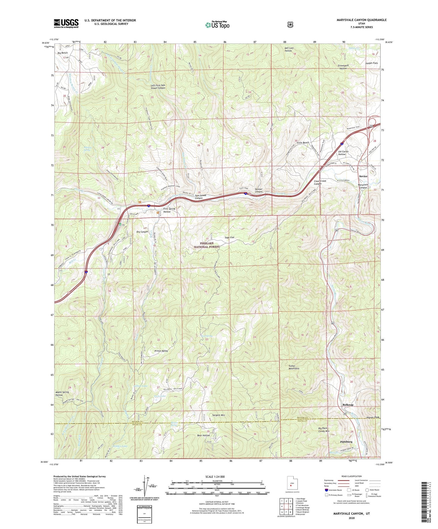
2020 topographic map quadrangle Marysvale Canyon in the state of Utah. Scale: 1:24000. Based on the newly updated USGS 7.5' US Topo map series, this map is in the following counties: Sevier, Piute. The map contains contour data, water features, and other items you are used to seeing on USGS maps, but also has updated roads and other features. This is the next generation of topographic maps. Printed on high-quality waterproof paper with UV fade-resistant inks.
Quads adjacent to this one:
West: Trail Mountain
Northwest: Red Ridge
North: Joseph Peak
Northeast: Elsinore
East: Antelope Range
Southeast: Marysvale
South: Mount Brigham
Southwest: Mount Belknap
Contains the following named places: Belknap, Belknap Ranger Station, Big Bench, Big Rock Candy Mountain, BW and H Mine, Castle Rock Campground, Clear Creek, Clear Creek Canyon, Deer Creek, Dry Canyon, Dry Creek, Dry Wash, First Spring, First Spring Hollow, Fremont Indian State Park, Hidden Lake, Hoover Peak, Hoovers, Icicle Bench, Joe Lott Creek, Left Fork Sam Stowe Canyon, Left Fork Sam Stowe Creek, Marysvale Canyon, Mill Creek, Pittsburg, Prince Valley, Sage Flat, Sam Stowe Canyon, Sam Stowe Creek, Sargent Lake, Sargent Mountain, Sevier, Sevier River Bend Recreation Site, Sid Carter Hollow, Skinner Canyon, Skinner Spring, Twin Lake, West Fork Joe Lott Creek, Whiskey Spring, Whiskey Spring Creek, Willow Lake, Yellow Cougar Mine, ZIP Code: 84766