
MyTopo
Minersville Reservoir Utah US Topo Map
Couldn't load pickup availability
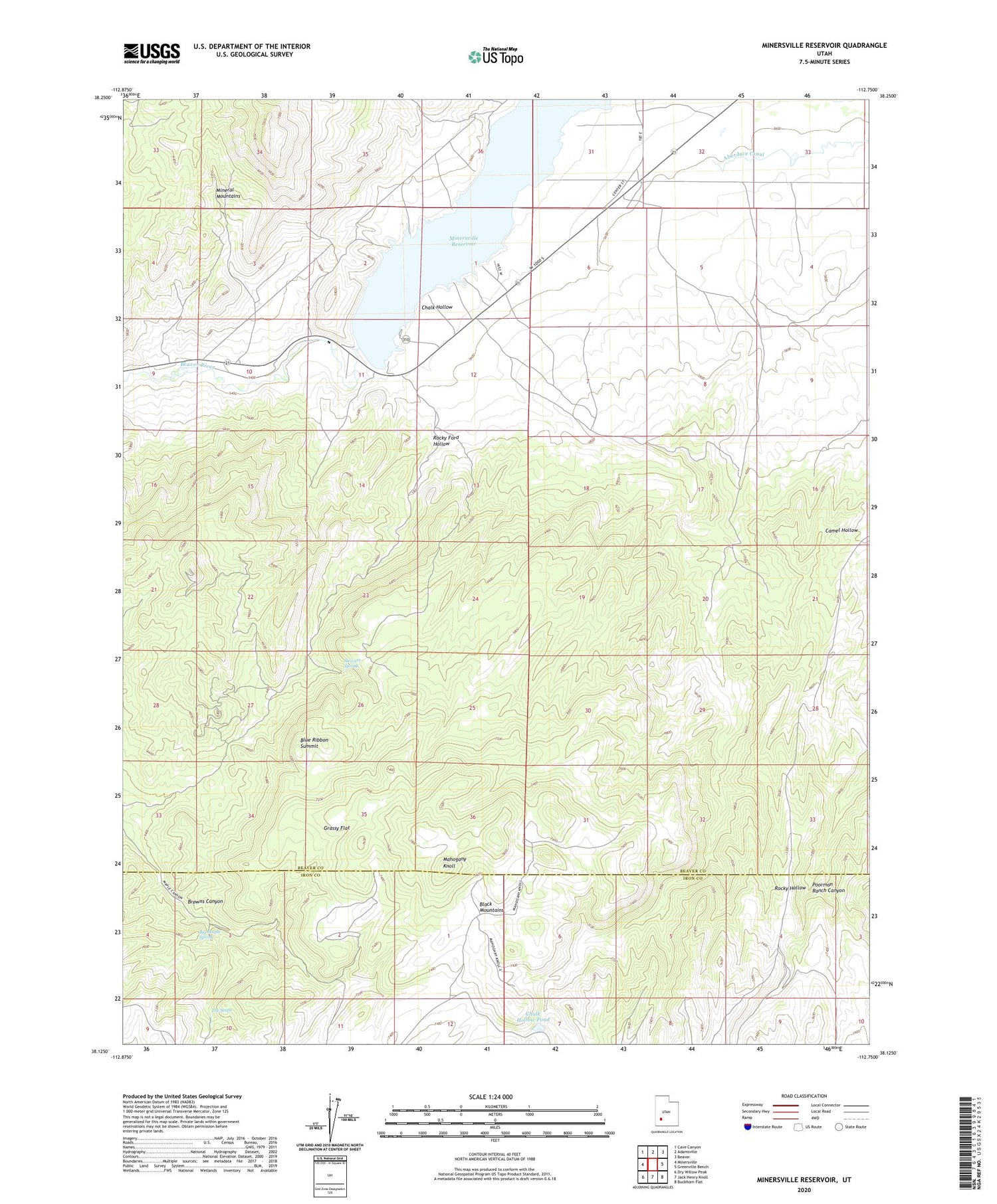
2020 topographic map quadrangle Minersville Reservoir in the state of Utah. Scale: 1:24000. Based on the newly updated USGS 7.5' US Topo map series, this map is in the following counties: Beaver, Iron. The map contains contour data, water features, and other items you are used to seeing on USGS maps, but also has updated roads and other features. This is the next generation of topographic maps. Printed on high-quality waterproof paper with UV fade-resistant inks.
Quads adjacent to this one:
West: Minersville
Northwest: Cave Canyon
North: Adamsville
Northeast: Beaver
East: Greenville Bench
Southeast: Buckhorn Flat
South: Jack Henry Knoll
Southwest: Dry Willow Peak
Contains the following named places: Big Maple Spring, Blue Ribbon Mine, Blue Ribbon Summit, Browns Canyon, Camel Hollow, Chalk Hollow, Chalk Hollow Pond, Goules Mine, Grassy Flat, Mahogany Knoll, Minersville Campground, Minersville Reservation Recreation Site, Minersville Reservoir, Minersville State Park, Poorman Ranch Canyon, Rocky Ford Dam, Rocky Ford Hollow, Stewart Spring, The Seeps, ZIP Code: 84752


