MyTopo
Monticello Lake Utah US Topo Map
Couldn't load pickup availability
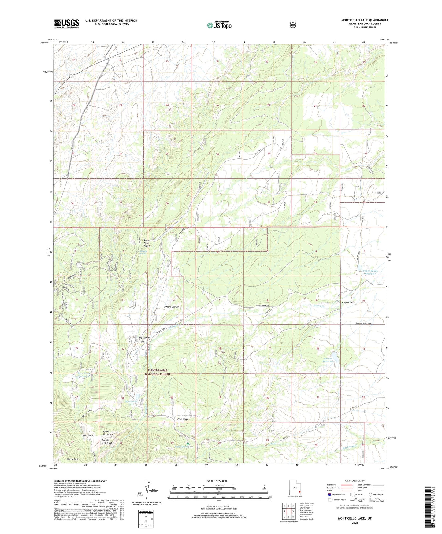
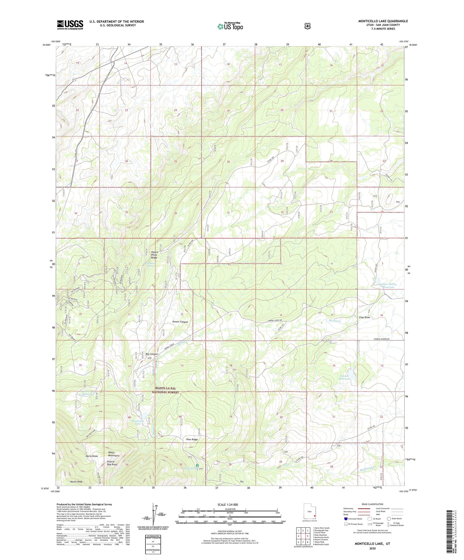
2020 topographic map quadrangle Monticello Lake in the state of Utah. Scale: 1:24000. Based on the newly updated USGS 7.5' US Topo map series, this map is in the following counties: San Juan. The map contains contour data, water features, and other items you are used to seeing on USGS maps, but also has updated roads and other features. This is the next generation of topographic maps. Printed on high-quality waterproof paper with UV fade-resistant inks.
Quads adjacent to this one:
West: Shay Mountain
Northwest: Harts Point South
North: Photograph Gap
Northeast: Church Rock
East: Monticello North
Southeast: Monticello South
South: Abajo Peak
Southwest: Mount Linnaeus
Contains the following named places: Buckboard Campground, Clay Draw, Gordon Dam, Gordon Reservoir, Harts Draw-Canyonlands Point of Interest, Jackson Spring, Monticello Lake, Monticello Lake Dam, Peters Point Ridge, Pine Ridge, Prairie Dog Knoll, Race Track Reservoir, Taylor Spring, The Race Track, Upper Bailey Dam, Upper Bailey Reservoir