MyTopo
Mount Tukuhnikivatz Utah US Topo Map
Couldn't load pickup availability
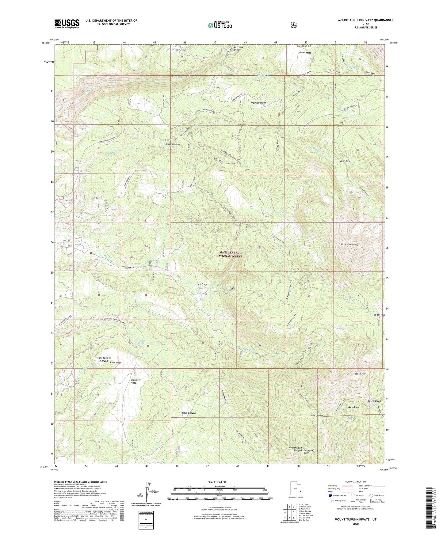
2020 topographic map quadrangle Mount Tukuhnikivatz in the state of Utah. Scale: 1:24000. Based on the newly updated USGS 7.5' US Topo map series, this map is in the following counties: San Juan, Grand. The map contains contour data, water features, and other items you are used to seeing on USGS maps, but also has updated roads and other features. This is the next generation of topographic maps. Printed on high-quality waterproof paper with UV fade-resistant inks.
Quads adjacent to this one:
West: Kane Springs
Northwest: Rill Creek
North: Warner Lake
Northeast: Mount Waas
East: Mount Peale
Southeast: La Sal East
South: La Sal West
Southwest: La Sal Junction
Contains the following named places: Black Ridge, Boren Mesa, Brumley Ridge, Carpenter Basin, Chess Ridge Mine, Clark Lake, Dorry Canyon, Gold Basin, Gold Basin Tower, Hell Canyon, Horse Creek, La Sal Mountains, La Sal Pass, LaSal Mountain Loop Road Auto Tour, LaSal Pass Mine, M4 Ranch, Mill Creek Bridge, Mount Tukuhnikivatz, Pack Creek Picnic Area, San Juan Fire Department - Pack Creek Station, Slaughter Flats, Slaughter Spring, South Mountain, Squaw Spring, Yellow Circle Mines