
MyTopo
Panguitch Utah US Topo Map
Couldn't load pickup availability
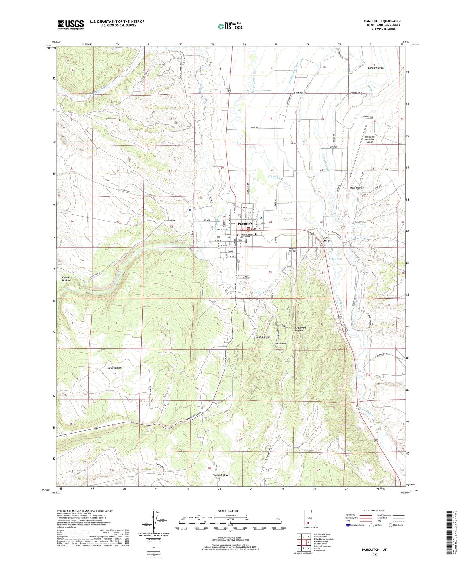
2020 topographic map quadrangle Panguitch in the state of Utah. Scale: 1:24000. Based on the newly updated USGS 7.5' US Topo map series, this map is in the following counties: Garfield. The map contains contour data, water features, and other items you are used to seeing on USGS maps, but also has updated roads and other features. This is the next generation of topographic maps. Printed on high-quality waterproof paper with UV fade-resistant inks.
Quads adjacent to this one:
West: Fivemile Ridge
Northwest: Little Creek Peak
North: Panguitch NW
Northeast: Blind Spring Mountain
East: Casto Canyon
Southeast: Wilson Peak
South: Hatch
Southwest: Haycock Mountain
Contains the following named places: Butler Wash, Casto Wash, City of Panguitch, DD Hollow, East Bench, East Bench Canal, East Panguitch Canal, Fivemile Hollow, Garfield County Ambulance, Garfield County Fairgrounds, Garfield County Jail, Garfield County Sheriff's Office Panquitch, Garfield Memorial Hospital, Graveyard Hollow, Hitch-N-Post Campground, Limekiln Creek, Limekiln Draw, Long Canal, Panguitch, Panguitch City Cemetery, Panguitch Creek, Panguitch Division, Panguitch Elementary School, Panguitch High School, Panguitch KOA, Panguitch Municipal Airport, Panguitch Post Office, Panguitch Volunteer Fire Department, Peterson Wash, Powell District Ranger Station, Race Hollow, Riggs Pond, Roller Mill Hill, Sheep Hollow, South Canyon, South Ditch, The Church of Jesus Christ of Latter Day Saints, Threemile Creek, United States Forest Service Fire Station - Panguitch Office, West Ditch


