MyTopo
Rainbow Bridge Utah US Topo Map
Couldn't load pickup availability
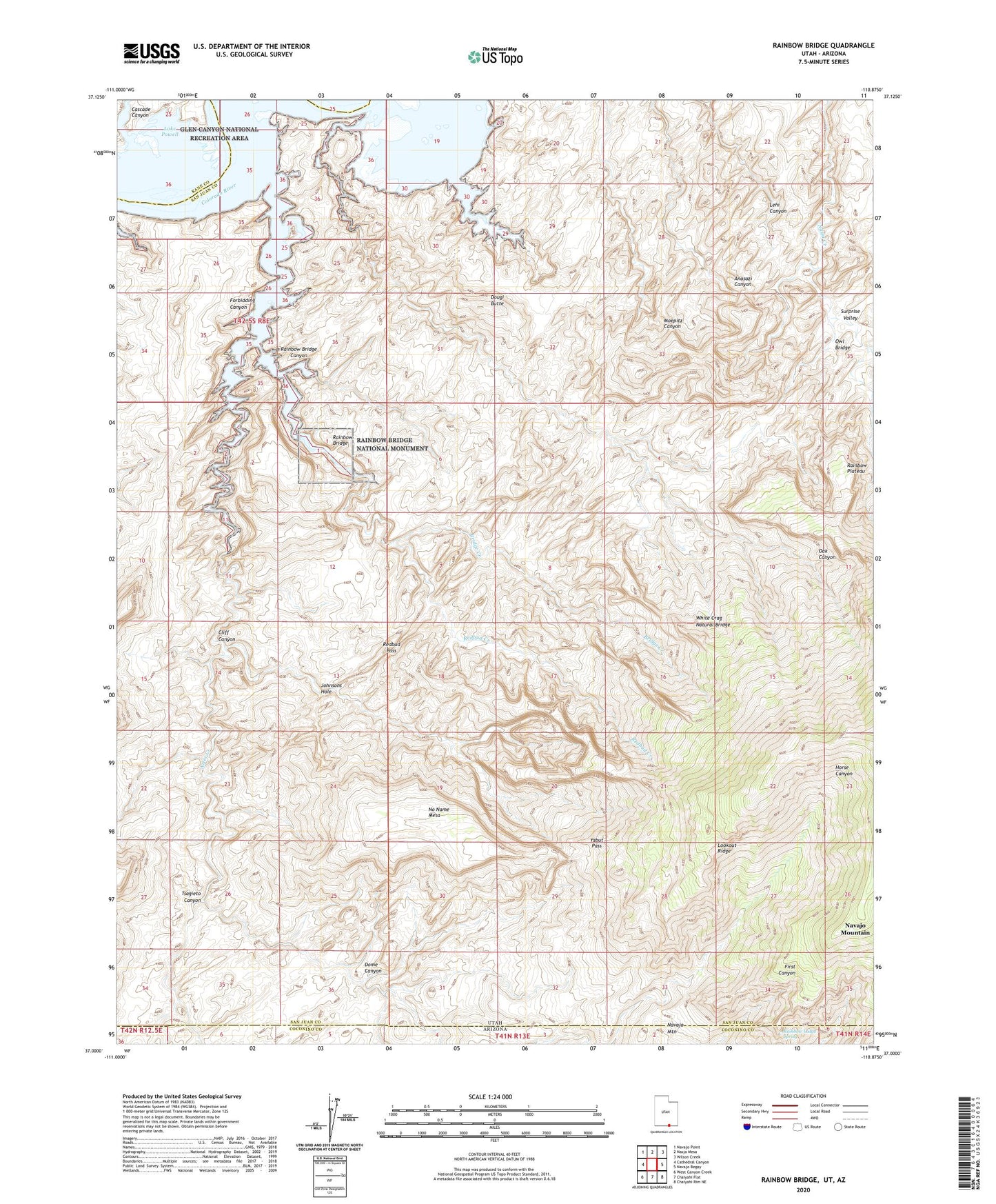
2020 topographic map quadrangle Rainbow Bridge in the states of Arizona, Utah. Scale: 1:24000. Based on the newly updated USGS 7.5' US Topo map series, this map is in the following counties: San Juan, Coconino, Kane. The map contains contour data, water features, and other items you are used to seeing on USGS maps, but also has updated roads and other features. This is the next generation of topographic maps. Printed on high-quality waterproof paper with UV fade-resistant inks.
Quads adjacent to this one:
West: Cathedral Canyon
Northwest: Navajo Point
North: Nasja Mesa
Northeast: Wilson Creek
East: Navajo Begay
Southeast: Chaiyahi Rim NE
South: Chaiyahi Flat
Southwest: West Canyon Creek
Contains the following named places: Aztec Creek, Bridge Creek, Cascade Canyon, Cliff Canyon, Dome Canyon, Dougi Butte, Echo Camp, Forbidding Canyon, Johnsons Hole, Lookout Ridge, Navajo Mountain Trailhead to Rainbow Bridge, No Name Mesa, Oak Canyon, Oak Glens, Owl Bridge, Painted Rocks, Rainbow Bridge, Rainbow Bridge Canyon, Rainbow Bridge Floating Marina, Rainbow Bridge National Monument, Rainbow Lodge Site Trailhead to Rainbow Bridge, Rainbow Lodge Spring, Redbud Creek, Redbud Pass, Surprise Valley, Tsagieto Canyon, White Crag Natural Bridge, Yabut Pass