MyTopo
Standrod Utah US Topo Map
Couldn't load pickup availability
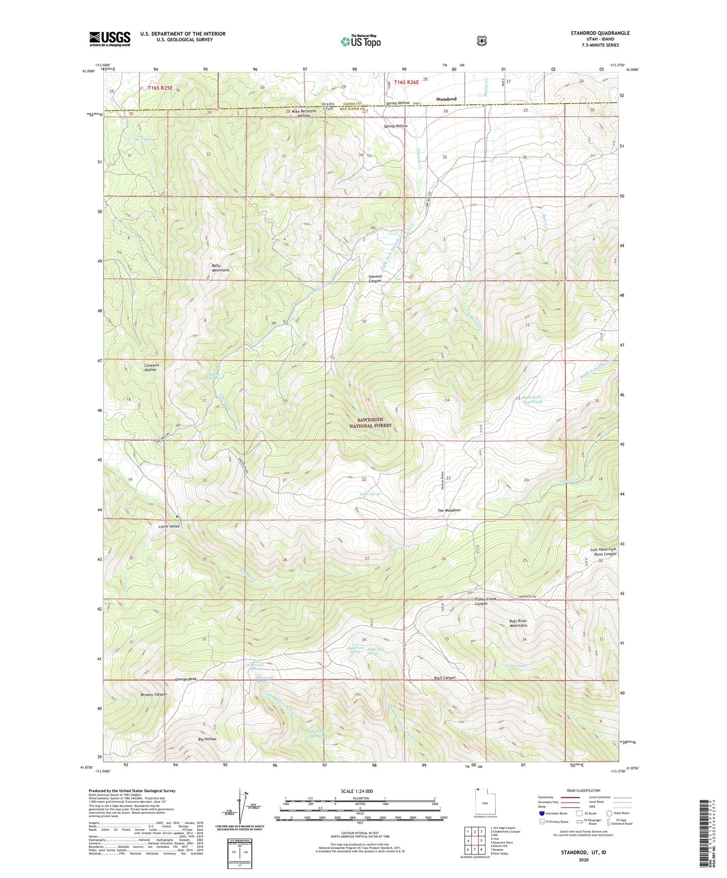
2020 topographic map quadrangle Standrod in the states of Idaho, Utah. Scale: 1:24000. Based on the newly updated USGS 7.5' US Topo map series, this map is in the following counties: Box Elder, Cassia. The map contains contour data, water features, and other items you are used to seeing on USGS maps, but also has updated roads and other features. This is the next generation of topographic maps. Printed on high-quality waterproof paper with UV fade-resistant inks.
Quads adjacent to this one:
West: Yost
Northwest: Jim Sage Canyon
North: Chokecherry Canyon
Northeast: Naf
East: Rosevere Point
Southeast: Park Valley
South: Rosette
Southwest: Dennis Hill
Contains the following named places: Bally Mountains, Cabin Spring, Dipping Vat Spring, Dry Fork Pine Creek, Fisher Lake, George Peak, Jones Creek, Little Valley, Mike Bernetta Hollow, Oliver Spring, Onemile Guard Station, Pine Creek Spring, Raft River Mountains, Right Fork Onemile Creek, Right Fork Spring, Sawmill Canyon, Sawtooth National Forest - Raft River Division, South Fork George Creek, Spring Hollow, Standrod, The Meadows