MyTopo
Thistle Utah US Topo Map
Couldn't load pickup availability
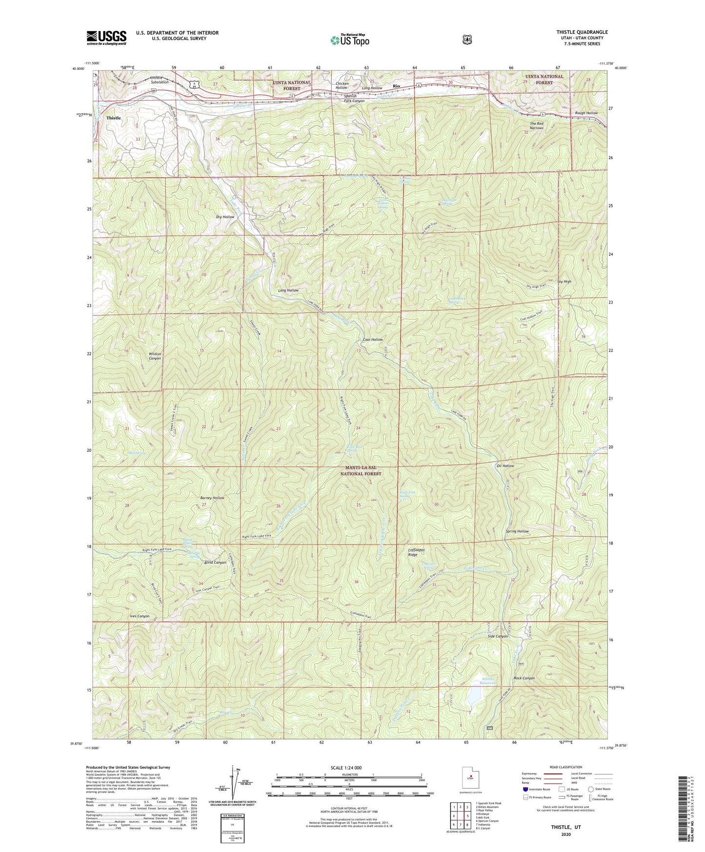
2020 topographic map quadrangle Thistle in the state of Utah. Scale: 1:24000. Based on the newly updated USGS 7.5' US Topo map series, this map is in the following counties: Utah. The map contains contour data, water features, and other items you are used to seeing on USGS maps, but also has updated roads and other features. This is the next generation of topographic maps. Printed on high-quality waterproof paper with UV fade-resistant inks.
Quads adjacent to this one:
West: Birdseye
Northwest: Spanish Fork Peak
North: Billies Mountain
Northeast: Rays Valley
East: Mill Fork
Southeast: C Canyon
South: Indianola
Southwest: Spencer Canyon
Contains the following named places: Buggy Wheel Spring, Chicken Hollow, Coal Hollow, Coal Hollow Spring, Coffeepot Creek, Coffeepot Ridge, Coffeepot Spring, Dipping Pen Creek, Dry Hollow, Jumpup Spring, Lake Fork, Lake Fork Wildlife Management Area, Left Fork Lake Fork, Left Fork Right Fork, Little Bear Spring, Long Hollow, Long Hollow Spring, Lookout Spring, Mud Spring, Oil Hollow, Right Fork, Right Fork Lake Fork, Right Fork Spring, Rio, Rock Canyon, Rough Hollow, Side Canyon, Sky High, Sky High Spring, Sky High Trail, Slab Pile Spring, Smiths Dam, Smiths Reservoir, Soldier Creek, Spring Hollow, Sweat Creek, The Red Narrows, Thistle, Thistle Creek, Thistle Substation