MyTopo
Whistler Canal Utah US Topo Map
Couldn't load pickup availability
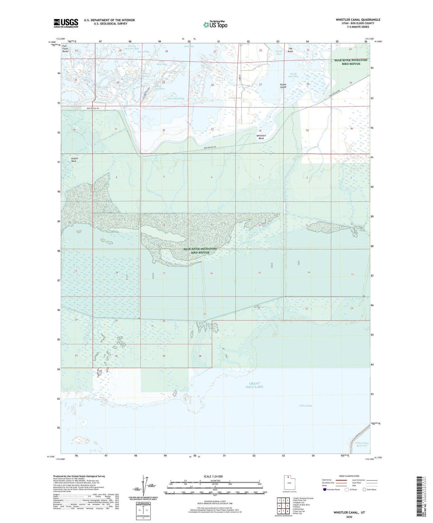
2020 topographic map quadrangle Whistler Canal in the state of Utah. Scale: 1:24000. Based on the newly updated USGS 7.5' US Topo map series, this map is in the following counties: Box Elder. The map contains contour data, water features, and other items you are used to seeing on USGS maps, but also has updated roads and other features. This is the next generation of topographic maps. Printed on high-quality waterproof paper with UV fade-resistant inks.
Quads adjacent to this one:
West: Mouth of Bear River
Northwest: Public Shooting Grounds
North: Bear River City
Northeast: Brigham City
East: Willard
Southeast: Plain City
South: Plain City SW
Southwest: Willard Spur
Contains the following named places: Bristol Bay, Browns Overflow, Chesapeake Duck Club, East Lateral, Glory Hole, Goose Island, Homestead Bay, Kendall Canal, Little Bear Bay, Mueller Lake, North Pass, Rillas Overflow, South East Bay, West Lateral, Whistler Canal, Whistlers Bend, Willard Bay, Willow Creek, Woods Creek