MyTopo
Willard Utah US Topo Map
Couldn't load pickup availability
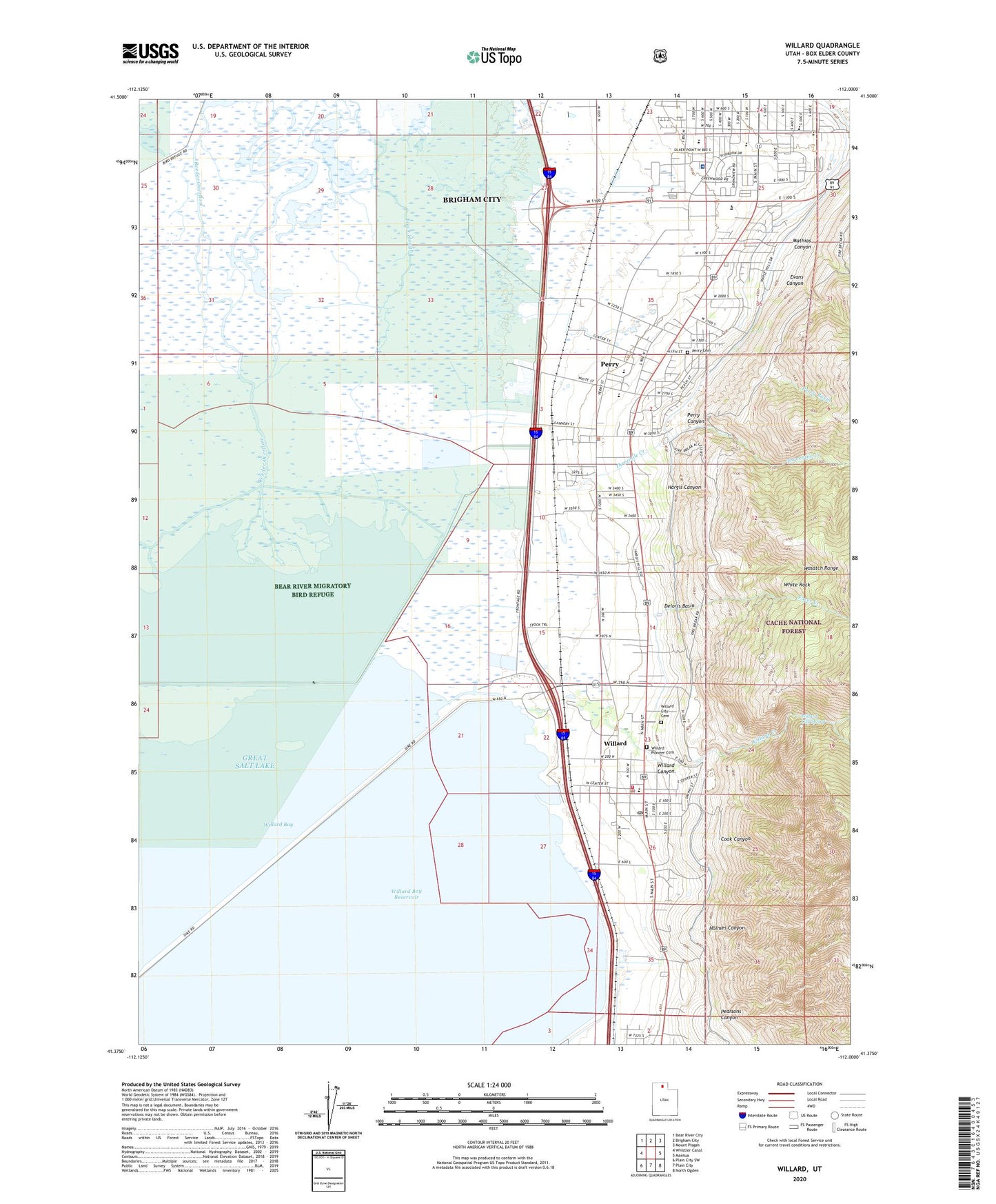
2020 topographic map quadrangle Willard in the state of Utah. Scale: 1:24000. Based on the newly updated USGS 7.5' US Topo map series, this map is in the following counties: Box Elder. The map contains contour data, water features, and other items you are used to seeing on USGS maps, but also has updated roads and other features. This is the next generation of topographic maps. Printed on high-quality waterproof paper with UV fade-resistant inks.
Quads adjacent to this one:
West: Whistler Canal
Northwest: Bear River City
North: Brigham City
Northeast: Mount Pisgah
East: Mantua
Southeast: North Ogden
South: Plain City
Southwest: Plain City SW
Contains the following named places: Aldersgate United Methodist Church, Arthur V Watkins Dam, Black Slough, Brigham City Bible Church, Brigham City Community Hospital, Brigham City Community Hospital Heliport, Brigham City Division, Brigham City Shopping Center, Christian Reformed Church, City of Perry, City of Willard, Cook Canyon, Deloris Basin, Evans Canyon, Facer Creek, Hargis Canyon, Holmes Canyon, Intermountain Indian School, La Hermosa Assembly, Lake View Elementary School, Mathias Canyon, Mountain View Elementary School, North Recreation Area, Pearsons Canyon, Perry, Perry Basin, Perry Canal, Perry Canyon, Perry Cemetery, Perry Police Department, Perry School, Perry Siding, Reeder Overflow, RV Acres Campground, Saint Michaels Episcopal Church, The Church of Jesus Christ of Latter Day Saints, Threemile Creek, West Fork Willard Creek, White Rock, Willard, Willard Bay North Marina Campground, Willard Bay Reservoir, Willard Canyon, Willard City Cemetery, Willard City Fire Department and First Responders, Willard City Spring, Willard Creek, Willard Elementary School, Willard Pioneer Cemetery, Willard Police Department, Willard Post Office