MyTopo
Aspen Virginia US Topo Map
Couldn't load pickup availability
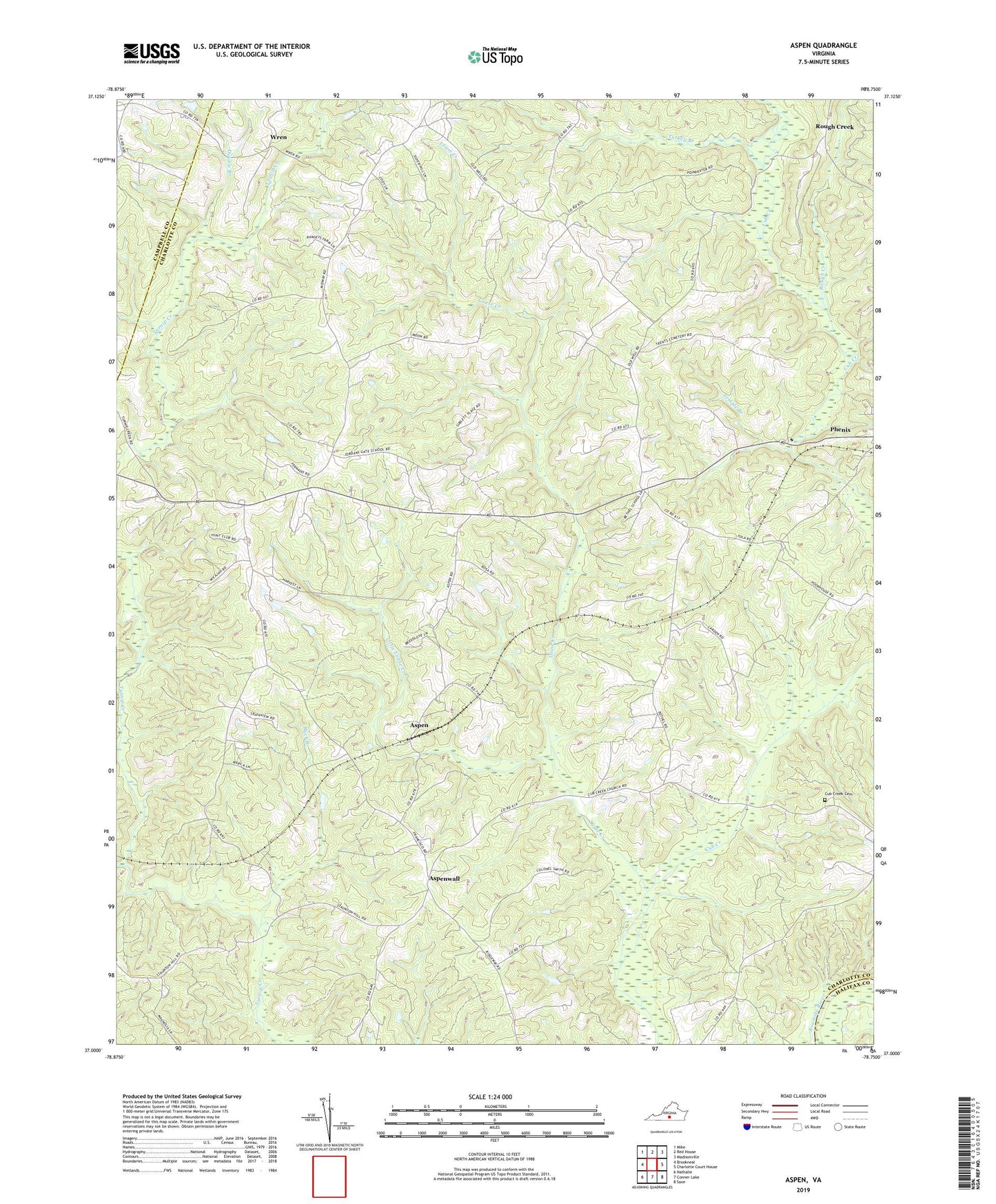
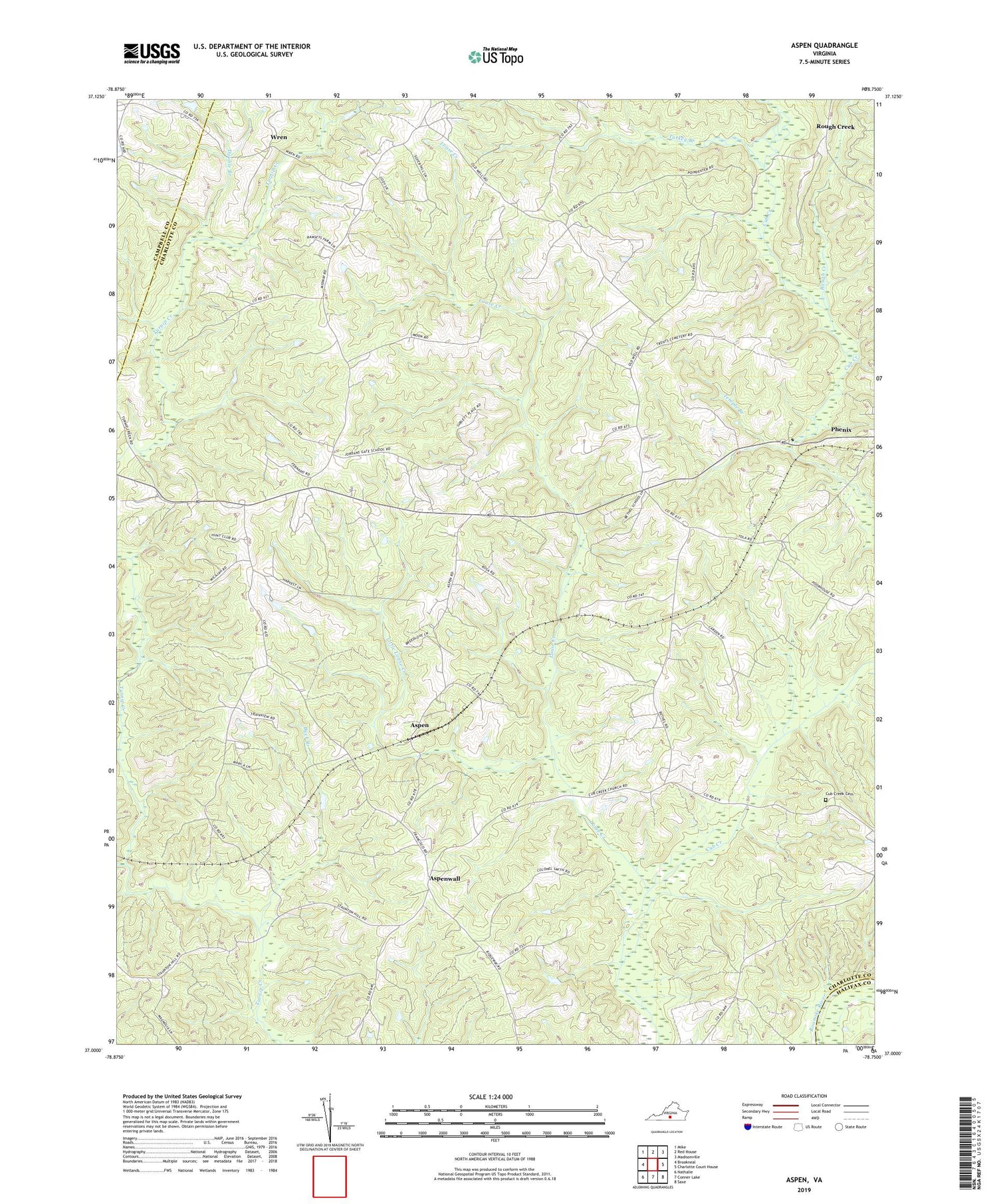
2019 topographic map quadrangle Aspen in the state of Virginia. Scale: 1:24000. Based on the newly updated USGS 7.5' US Topo map series, this map is in the following counties: Charlotte, Campbell, Halifax. The map contains contour data, water features, and other items you are used to seeing on USGS maps, but also has updated roads and other features. This is the next generation of topographic maps. Printed on high-quality waterproof paper with UV fade-resistant inks.
Quads adjacent to this one:
West: Brookneal
Northwest: Mike
North: Red House
Northeast: Madisonville
East: Charlotte Court House
Southeast: Saxe
South: Conner Lake
Southwest: Nathalie
Contains the following named places: Abell, Aspen, Aspen Hill Church, Aspenwall, Baileyville, Bethel Church, Buck Branch, Camptown, Cub Creek Cemetery, Cub Creek Presbyterian Meeting House, Double Branch, Hope Church, Little Louse Creek, Louse Creek, Midway Church, Midway District, Mount Carmel Church, Nazareth Church, Old Well, Roanoke Church, Rough Creek, Temple Branch, Turkey Branch, Wren, ZIP Code: 23959