MyTopo
Buckhorn Virginia US Topo Map
Couldn't load pickup availability
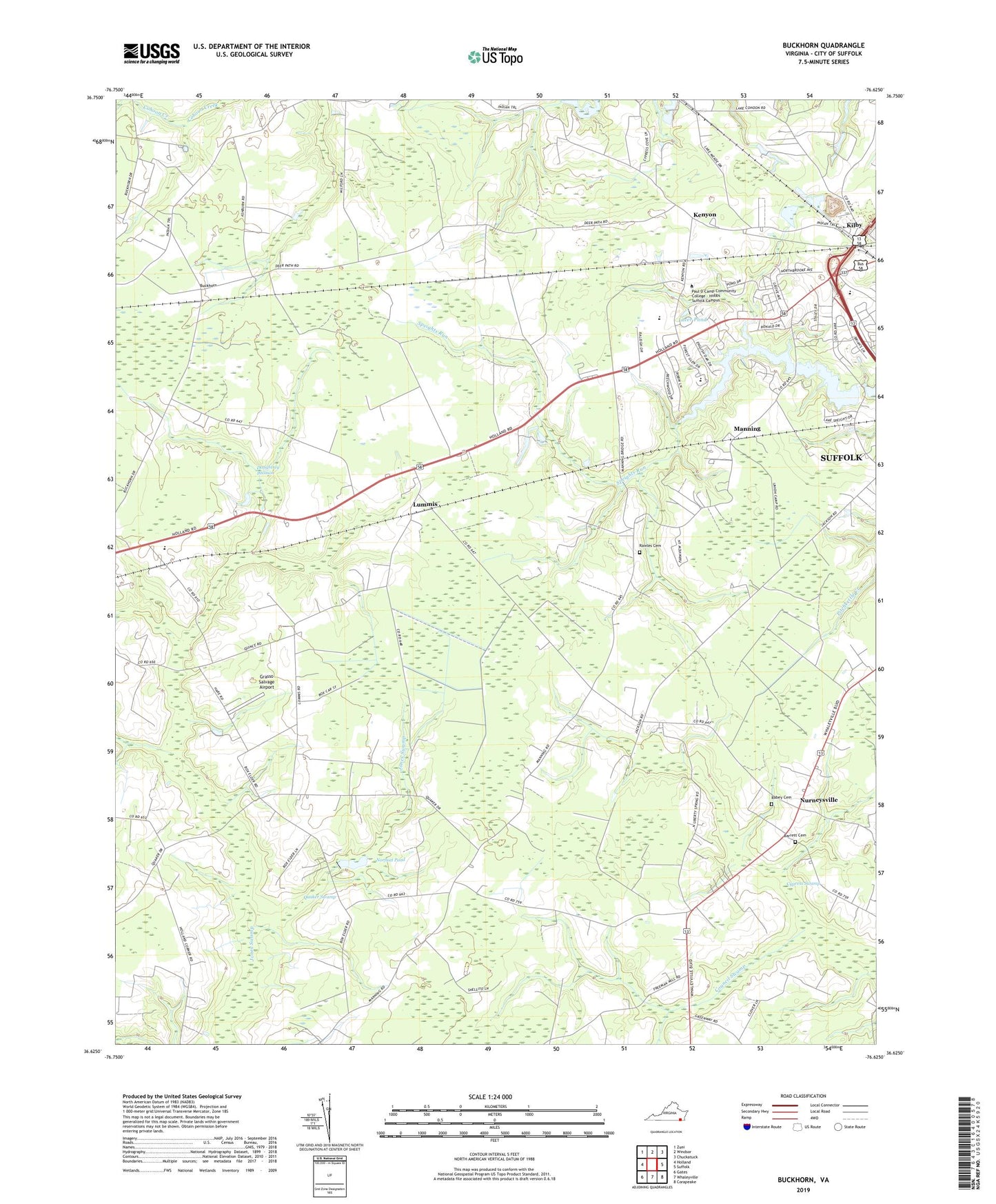
2019 topographic map quadrangle Buckhorn in the state of Virginia. Scale: 1:24000. Based on the newly updated USGS 7.5' US Topo map series, this map is in the following counties: Suffolk (city). The map contains contour data, water features, and other items you are used to seeing on USGS maps, but also has updated roads and other features. This is the next generation of topographic maps. Printed on high-quality waterproof paper with UV fade-resistant inks.
Quads adjacent to this one:
West: Holland
Northwest: Zuni
North: Windsor
Northeast: Chuckatuck
East: Suffolk
Southeast: Corapeake
South: Whaleyville
Southwest: Gates
Contains the following named places: Bakers Crossing, Barrett Acres, Barrett Cemetery, Bethlehem Church, Bethlehem Court, Bethlehem School, Bethlehem Terrace, Box Elder, Boxelder School, Buckhorn, City of Suffolk, Copeland Pond, Council Swamp, Daughtrey Pocoson, El Bethel Worship Center, Forest Glen Middle School, Forest Glen Terrace, Galatian United Christian Church, Gethsemane Church, Grasso Salvage Airport, Hillsdale, Kenyon, Kilby, Kilby Shores Elementary School, Lake Kilby Boat Ramp, Lake Speight Colony, Lakeland High School, Lakewood, Leesville, Liberty Spring Church, Little Tabernacle, Lummis, Luter Pond, Lutersville, Manning, Maple Hill, Noah Howell School, Norfleet Dam, Norfleet Pond, Nurneysville, Oak Ridge, Oak Ridge East, Oak Ridge Estates, Paul D Camp Community College - Hobbs Suffolk Campus, Pinaire, Pine Grove Church, Quaker Swamp, Rabey Cemetery, Rawles Cemetery, Savage Crossing School, Somerton Friends Meeting House, Speights Run, Speights Run Dam, Speights Run Reservoir, Suffolk Animal Control Bureau, Westgate, Zion Church