MyTopo
Elliott Knob Virginia US Topo Map
Couldn't load pickup availability
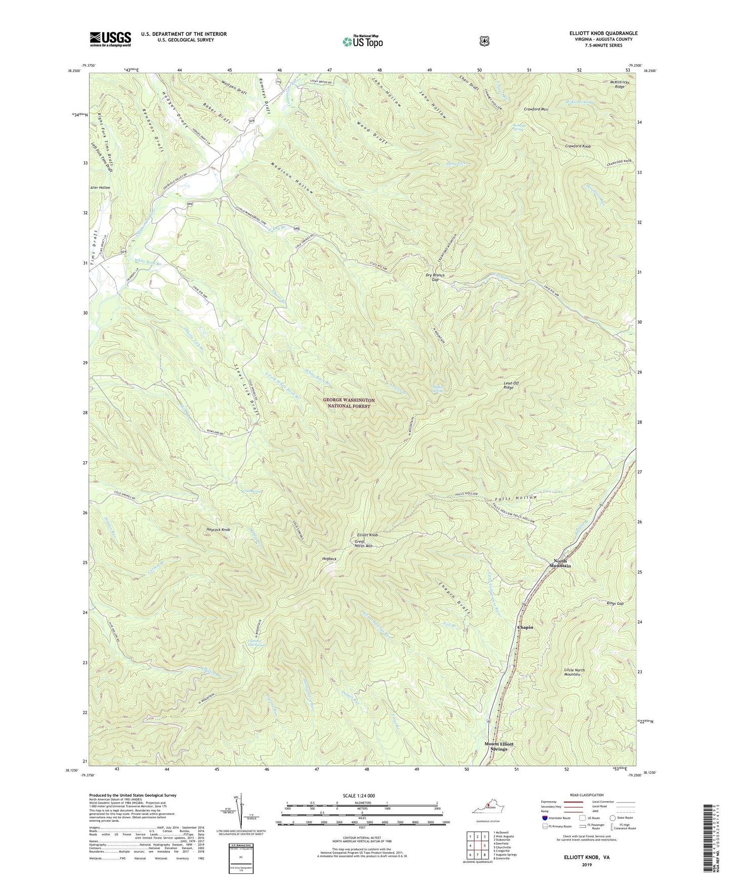
2019 topographic map quadrangle Elliott Knob in the state of Virginia. Scale: 1:24000. Based on the newly updated USGS 7.5' US Topo map series, this map is in the following counties: Augusta. The map contains contour data, water features, and other items you are used to seeing on USGS maps, but also has updated roads and other features. This is the next generation of topographic maps. Printed on high-quality waterproof paper with UV fade-resistant inks.
Quads adjacent to this one:
West: Deerfield
Northwest: McDowell
North: West Augusta
Northeast: Stokesville
East: Churchville
Southeast: Greenville
South: Augusta Springs
Southwest: Craigsville
Contains the following named places: Alier Hollow, Baker Draft, Buffalo Spring, Chapin, Chapin Draft, Charlie Lick Branch, Chestnut Flat Spring, Chimney Hollow Trail, Clay Hill Church, Cold Spring, Crawford Knob, Crawford Knob Trail, Crawford Mountain, Dry Branch Gap, Elliot Knob Lookout Tower, Elliott Knob, Elliott Knob Trail, Elliott Springs Run, Fall Branch, Falls Hollow, George Washington National Forest, Great North Mountain, Haycock Knob, Hodges Draft, Hogback, Kings Gap, Laurel Branch, Lead-Off Ridge, Left Fork Tims Draft, Little North Mountain Trail, Madison Hollow, Mount Elliott Post Office, Mount Elliott Springs, North Mountain, Pastures District, Ramseys Draft, Ray Memorial Church, Red Oak Spring, Reubens Draft, Right Fork Tims Draft, Rock Lick, Shillings Trail, South Fork White Rock Branch, Steel Lick Draft, Stony Lick, Trimbles Mill Trail, West August Church, West Dry Branch, White Rock Branch, Wolfpen Draft, Wood Draft, WTON-FM (Staunton), WVPT-TV (Staunton)