MyTopo
Germanna Bridge Virginia US Topo Map
Couldn't load pickup availability
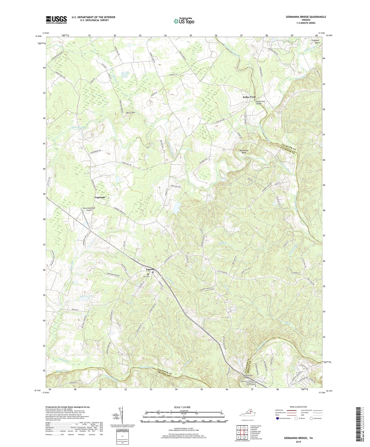
2019 topographic map quadrangle Germanna Bridge in the state of Virginia. Scale: 1:24000. Based on the newly updated USGS 7.5' US Topo map series, this map is in the following counties: Culpeper, Fauquier, Orange. The map contains contour data, water features, and other items you are used to seeing on USGS maps, but also has updated roads and other features. This is the next generation of topographic maps. Printed on high-quality waterproof paper with UV fade-resistant inks.
Quads adjacent to this one:
West: Culpeper East
Northwest: Brandy Station
North: Remington
Northeast: Midland
East: Richardsville
Southeast: Chancellorsville
South: Mine Run
Southwest: Unionville
Contains the following named places: Alice C Tyler Village of Childhelp School, Berry Hill, Berry Hill Mineral Springs, Brook Run, Camp Rapidan, Carrico, Culpeper Lookout Tower, Edwards Shop, Enchanted Castle, Fields Run, Flat Run, Germanna Bridge, Germanna Community College Locust Grove Campus, Germanna Ford, Harpers Run, Hawkins Dam, Hawkins Lake, Hoopers Run, Hopewell Church, Horseshoe Bend, Jennings Store, Kellys Ford, Kellys Ford Bridge, Lael Cemetery, Lael Church, Lagrange, Lick Branch, Lignum, Lignum Post Office, Mandsville Church, Marsh Run, Mill Run, Mine Run, Mount Holly, Mount Holly Church, Mountain Run, New Hope Church, Providence Church, South Lignum School, Stevensburg District, Stones Mill, The Greenhouse Airport, Whitetown, ZIP Codes: 22718, 22726, 22741