MyTopo
Lake Anna East Virginia US Topo Map
Couldn't load pickup availability
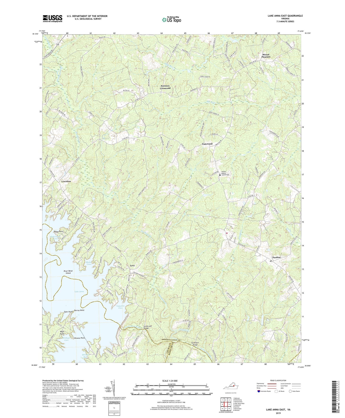
2019 topographic map quadrangle Lake Anna East in the state of Virginia. Scale: 1:24000. Based on the newly updated USGS 7.5' US Topo map series, this map is in the following counties: Spotsylvania, Louisa, Hanover, Caroline. The map contains contour data, water features, and other items you are used to seeing on USGS maps, but also has updated roads and other features. This is the next generation of topographic maps. Printed on high-quality waterproof paper with UV fade-resistant inks.
Quads adjacent to this one:
West: Lake Anna West
Northwest: Belmont
North: Brokenburg
Northeast: Spotsylvania
East: Ladysmith
Southeast: Hewlett
South: Beaverdam
Southwest: Buckner
Contains the following named places: Arnolds Creek, Bend, Blount Cove, Bones Island, Brents Landing, Browns Point, Burrus Point, Burruss Mill, Chewnings Corner, Dannys Hole, Davenport Bridge, David Creek, Duerson Store, Dukes Creek Marina, Fishermans Cove, Gatewood, Glebe Run, Jerdone Island, Levy, Lewiston, Little Rocky Creek, Livingston Elementary School, McGhee Bridge, Mount Olive Church, Mount Pleasant, New Hope Baptist Church, North Anna Dam, Northeast Creek, Partlow, Partlow Post Office, Penneys Crossroad, River Bend Island, Rock Creek, Rockland Creek, Saint Johns Church, Smiths Mill, Smiths Mill Bridge, Spotsylvania County Fire and Rescue Station 3, Spotsylvania Volunteer Rescue Squad Station 3, Talley Point, Tyler Point, Valentine Cove, Walkups Cove, Wallers Baptist Church Cemetery, Wallers Church, Ways Point, ZIP Code: 22534