MyTopo
Mine Run Virginia US Topo Map
Couldn't load pickup availability
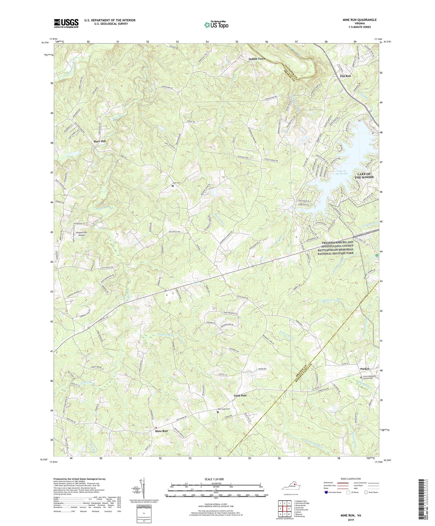
2019 topographic map quadrangle Mine Run in the state of Virginia. Scale: 1:24000. Based on the newly updated USGS 7.5' US Topo map series, this map is in the following counties: Orange, Spotsylvania, Culpeper. The map contains contour data, water features, and other items you are used to seeing on USGS maps, but also has updated roads and other features. This is the next generation of topographic maps. Printed on high-quality waterproof paper with UV fade-resistant inks.
Quads adjacent to this one:
West: Unionville
Northwest: Culpeper East
North: Germanna Bridge
Northeast: Richardsville
East: Chancellorsville
Southeast: Brokenburg
South: Belmont
Southwest: Lahore
Contains the following named places: Black Walnut Run, Burr Hill, Cormack Run, District 4, District 5, Flat Run, Flat Run Baptist Church, Gold Dale, Gospel Tabernacle, Grace Church, Grace Methodist Church Cemetery, Indian Town, Lake of the Woods, Lake of the Woods Census Designated Place, Lake of the Woods Dam, Little Russell Run, Locust Grove, Locust Grove Elementary School, Locust Grove Middle School, Mine Run, Mine Run Volunteer Fire Company, Mount Zion Baptist Church, New Hope Baptist Church, New Hope Cemetery, Parker, Russell Run, Saint Just, Simpsonville Airport, Soapstone Branch, Strawberry Branch, Wilderness Battlefield, Zoar Cemetery, Zoar Church, Zoar School, ZIP Codes: 22433, 22508