MyTopo
Moneta Virginia US Topo Map
Couldn't load pickup availability
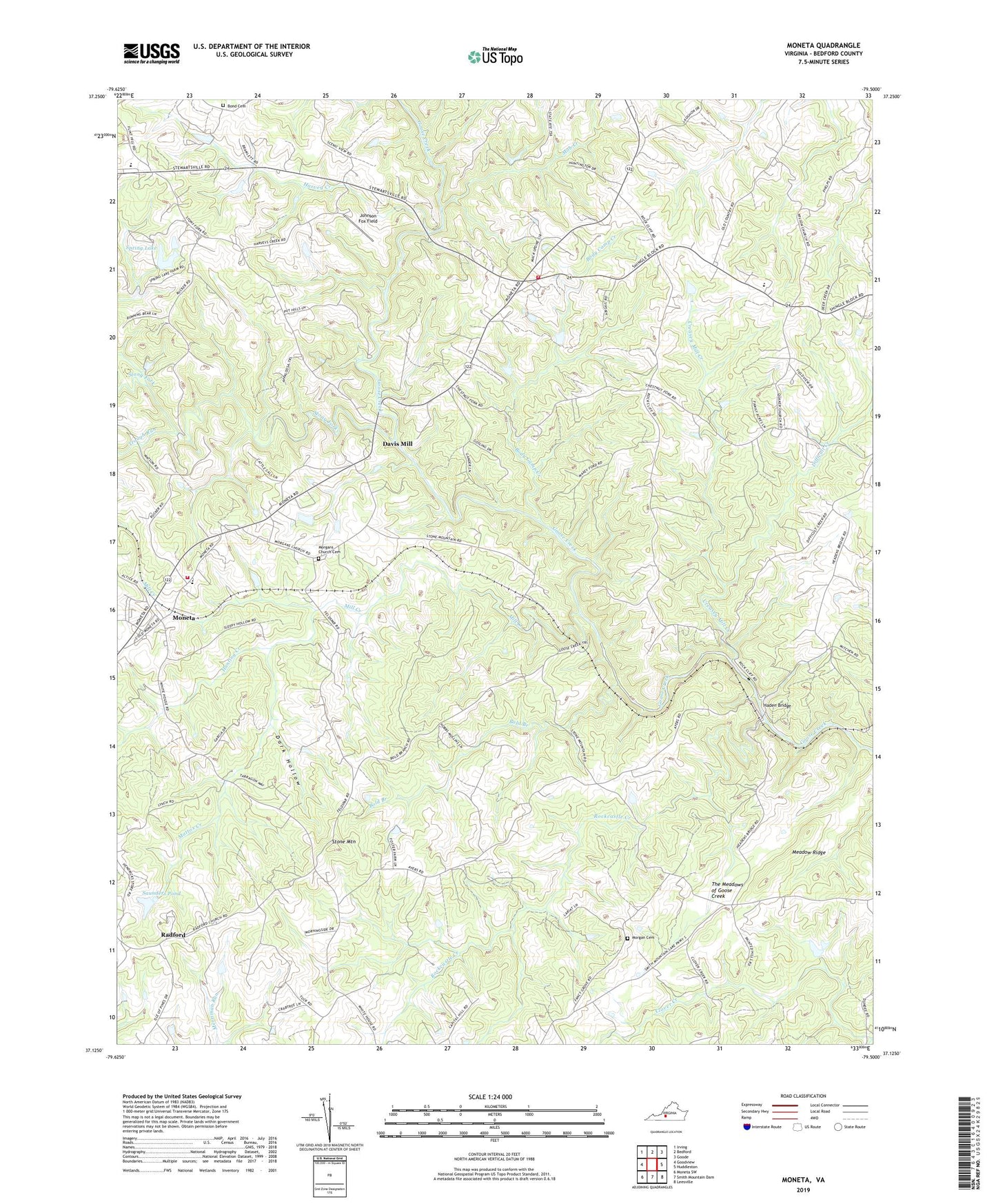
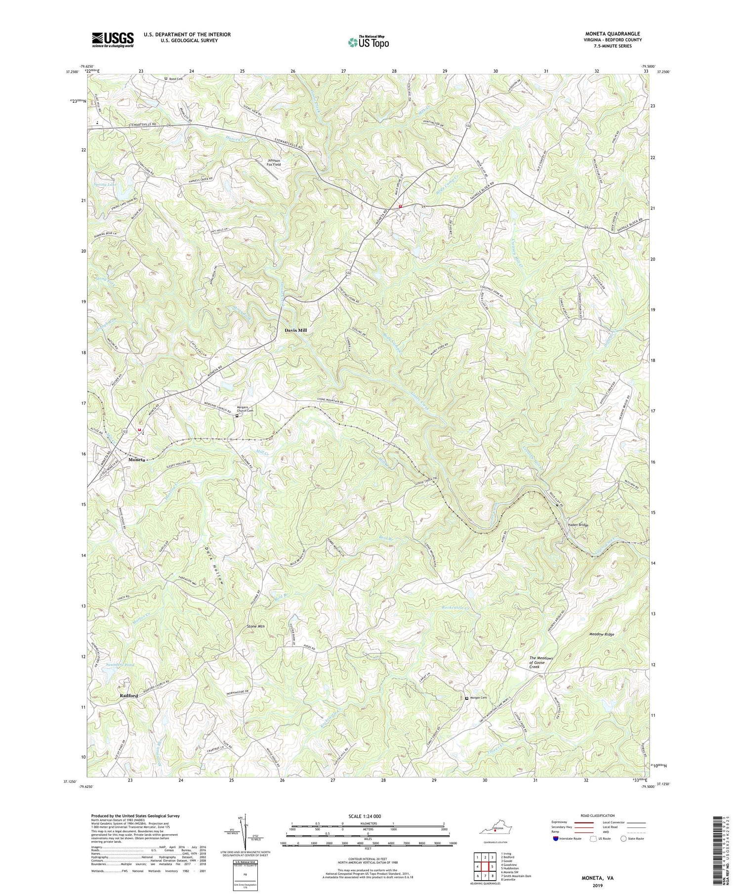
2019 topographic map quadrangle Moneta in the state of Virginia. Scale: 1:24000. Based on the newly updated USGS 7.5' US Topo map series, this map is in the following counties: Bedford. The map contains contour data, water features, and other items you are used to seeing on USGS maps, but also has updated roads and other features. This is the next generation of topographic maps. Printed on high-quality waterproof paper with UV fade-resistant inks.
Quads adjacent to this one:
West: Goodview
Northwest: Irving
North: Bedford
Northeast: Goode
East: Huddleston
Southeast: Leesville
South: Smith Mountain Dam
Southwest: Moneta SW
Contains the following named places: Bethlehem Church, Body Camp, Body Camp Creek, Body Camp Elementary School, Bold Branch, Bold Branch Church, Bond Cemetery, Clover Creek, Creasey Mill Creek, Dark Hollow, Davis Mill, Difficult Creek, District 2, Fancy Grove, Free Will Church, Haden Bridge, Harvey Creek, Hunting Creek, Johnson Fox Field, Lakes District, Mattox Creek, Meadow Ridge, Mill Creek, Mob Creek, Moneta, Moneta Census Designated Place, Moneta Elementary School, Moneta Rescue Squad Station 1, Moneta Rescue Squad Station 2, Moneta Volunteer Fire Department Company 8 Station 1, Moneta Volunteer Fire Department Station 2, Morgan Cemetery, Morgan Church, Morgans Church Cemetery, Mount Zion Baptist Church, New Providence Church, New Zion Church, Oak Grove Church, Palestine Church, Piney Grove School, Prison Camp Number 24, Promised Land Church, Quaker Church, Radford, Rockcastle Creek, Saunders Pond, Saunders Pond Dam, Shoulder Run, Spring Dam, Spring Lake, Staunton River High School, Stone Mountain, The Meadows of Goose Creek, Trough Run, Wilson Church