MyTopo
Surry Virginia US Topo Map
Couldn't load pickup availability
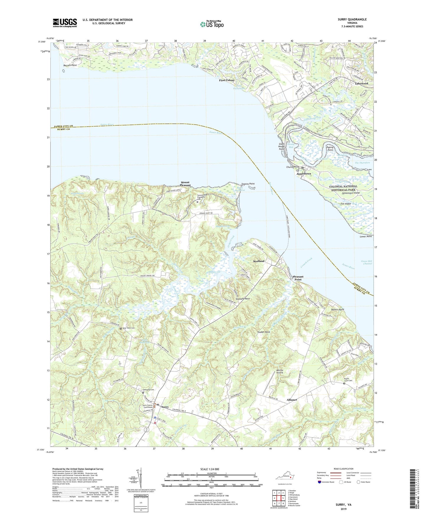
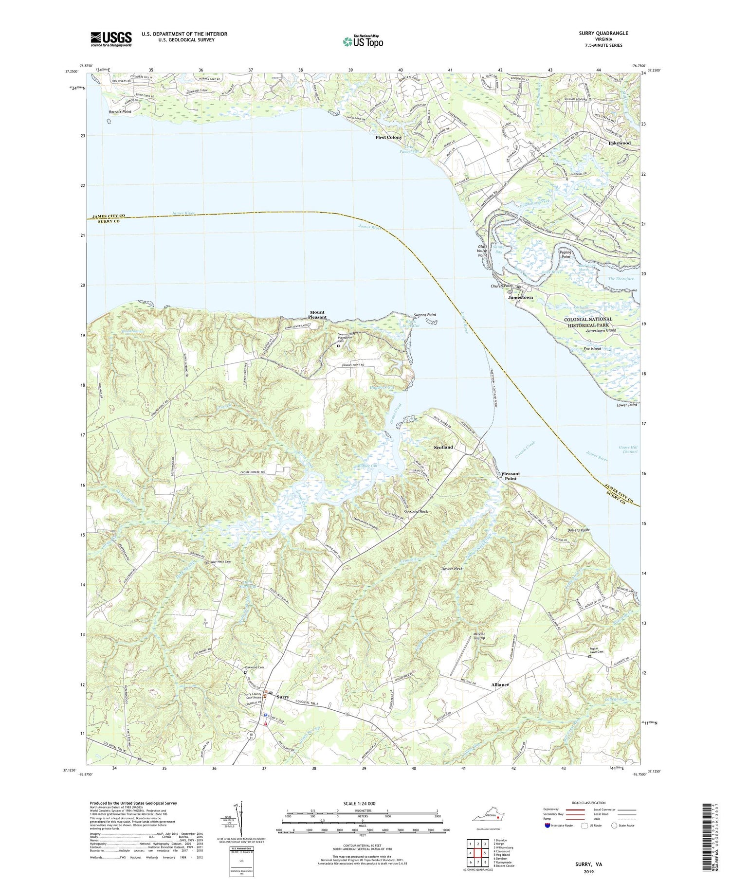
2019 topographic map quadrangle Surry in the state of Virginia. Scale: 1:24000. Based on the newly updated USGS 7.5' US Topo map series, this map is in the following counties: Surry, James City. The map contains contour data, water features, and other items you are used to seeing on USGS maps, but also has updated roads and other features. This is the next generation of topographic maps. Printed on high-quality waterproof paper with UV fade-resistant inks.
Quads adjacent to this one:
West: Claremont
Northwest: Brandon
North: Norge
Northeast: Williamsburg
East: Hog Island
Southeast: Bacons Castle
South: Runnymede
Southwest: Dendron
Contains the following named places: Alliance, Archaearium, Back River, Back River Marsh, Barrets Point, Berkeley District, Berkeleys Green, Black Duck Gut, Blizzards Corners, Broad Swamp, Camp Chanco, Camp Kiwanis, Cedar Field Creek, Church Point, Clara Byrd Baker Elementary School, Clarks Landing, Cobham Wharf, Cross Creek, Cross Creek Landing, Crouch Creek, Dark Swamp, Davis Landing, Dillard Wharf, Dollers Point, Earl Hall Mobile Home Park, First Colony, First Settlers Campground, Fort James, Four Mile Tree, Four-H Camp, Fox Island, Gate House Farms, Glass House, Glass House Point, Grace Union Church, Grays Creek, Grays Creek Marina, Grays Landing, Haystack Gut, Hulls Slash Gut, Indian Village Campground, Ingersoll, Jamestown, Jamestown Beach Campground, Jamestown Festival Park, Jamestown Island, Jamestown Post Office, Jamestown Yacht Basin, Jamestown-Scotland Wharf Ferry, Kingsmill Creek, Lake Pasbehegh, Lake Pasbehegh Dam, Lakewood, Lebanon Church, Lebanon School, Melville Airstrip, Mill Farm Run, Morris Grove Church, Mother Gut, Mount Pleasant, Newtown, Oakwood Cemetery, Old Courthouse Corners, Orchard Run, Passmore Creek, Peach Orchard Gut, Pitch and Tar Swamp, Pleasant Point, Poplar Lawn Cemetery, Poplar Lawn Church, Powhatan Creek, Powhatan Shores, Pyping Point, Saint Georges Hundred, Sandy Bay, Scotland, Scotland Census Designated Place, Scotland Neck, Smith Fort, Spring Run, Surry, Surry County Courthouse, Surry County Sheriff's Office, Surry District, Surry Post Office, Surry Public Library, Surry Volunteer Fire Department, Surry Volunteer Rescue Squad, Swanns Point, Swanns Point Plantation, Swanns Point Plantation Cemetery, Tandem Health Care of Williamsburg Nursing Home, The Church of Jesus Christ, Timber Neck, Timber Neck Creek, Town of Surry, Two Rivers Country Club, Warren House, Wier Neck Cemetery