MyTopo
Unionville Virginia US Topo Map
Couldn't load pickup availability
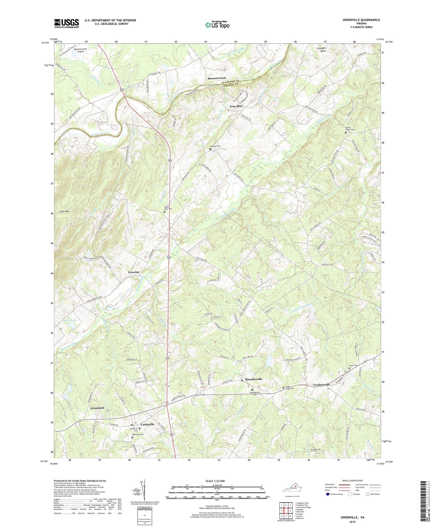
2019 topographic map quadrangle Unionville in the state of Virginia. Scale: 1:24000. Based on the newly updated USGS 7.5' US Topo map series, this map is in the following counties: Orange, Culpeper. The map contains contour data, water features, and other items you are used to seeing on USGS maps, but also has updated roads and other features. This is the next generation of topographic maps. Printed on high-quality waterproof paper with UV fade-resistant inks.
Quads adjacent to this one:
West: Rapidan
Northwest: Culpeper West
North: Culpeper East
Northeast: Germanna Bridge
East: Mine Run
Southeast: Belmont
South: Lahore
Southwest: Orange
Contains the following named places: Atlantic Research Corp Heliport, Battlefield Farms, Belmont Farm Airport, Bledsoe Corner, Cabin Branch, Cedar Run, Everona, Faith Christian Academy of Faith Bible Baptist Church, Finney Spring Branch, Grassland, House Lake, Long Branch, Mill Run, Mount Holy Cemetery, Mount Holy Church, Mount Pisgah Cemetery, Mount Pisgah Church, Mount Sinai Cemetery, Mount Sinai Church, Oakwood Cemetery, Orange County Rescue Squad Battlefield Garage, Orange County Rescue Squad Station 21, Palmyra Cemetery, Palmyra Church, Raccoon Branch, Raccoon Bridge, Raccoon Ford, Rhoadesville, Rhoadesville Baptist Church, Rhoadesville Cemetery, Rhoadesville Post Office, Rocky Branch, Saint Pauls Church, Salem Cemetery, Salem Church, Sleets Shop, Somerville Bridge, True Blue, True Blue School, Unionville, Unionville Cemetery, Unionville Christian Church, Unionville Elementary School, Unionville Post Office, Verdiersville, Walkers Branch, ZIP Code: 22542