
MyTopo
Azwell Washington US Topo Map
Couldn't load pickup availability
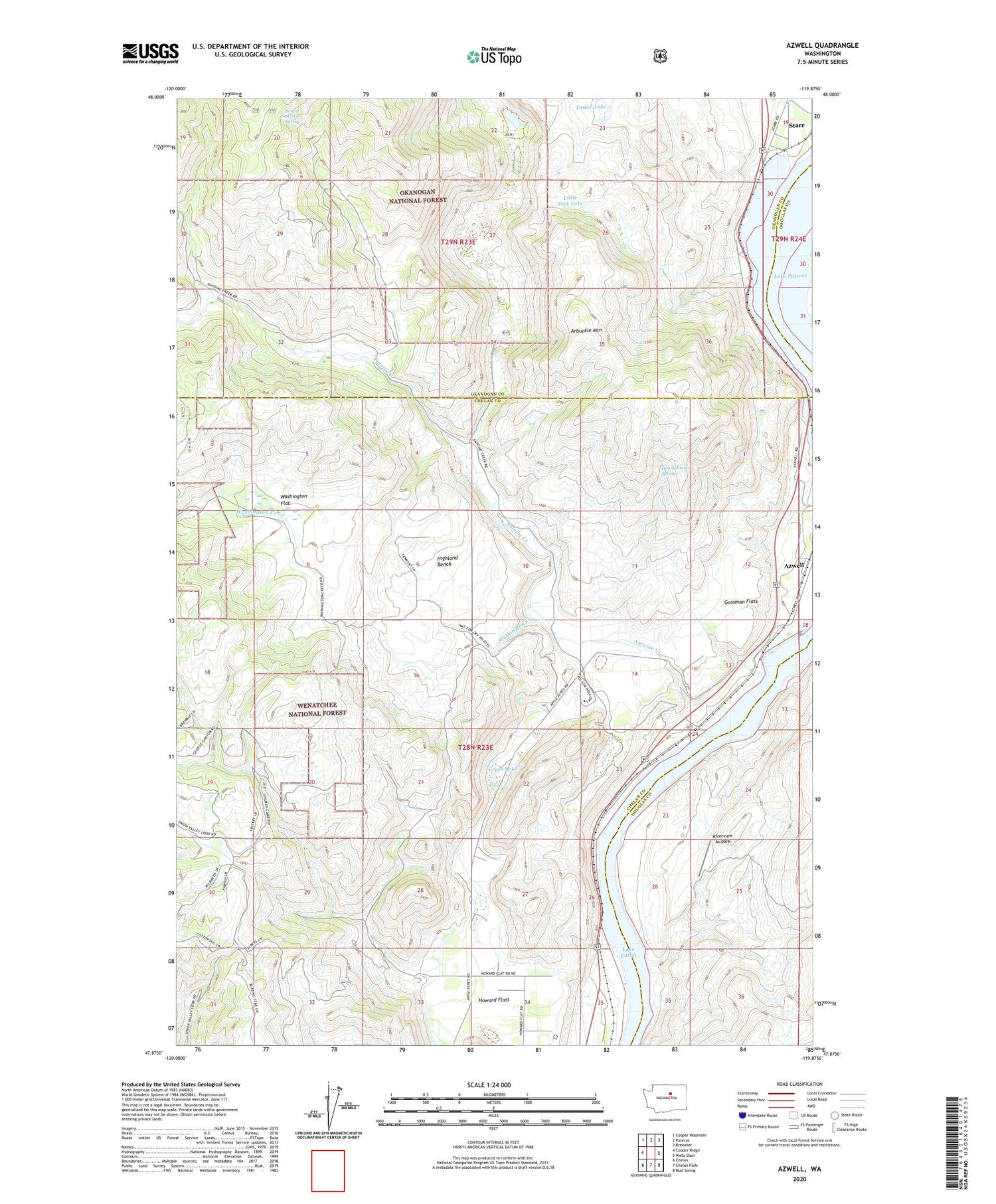
2020 topographic map quadrangle Azwell in the state of Washington. Scale: 1:24000. Based on the newly updated USGS 7.5' US Topo map series, this map is in the following counties: Chelan, Okanogan, Douglas. The map contains contour data, water features, and other items you are used to seeing on USGS maps, but also has updated roads and other features. This is the next generation of topographic maps. Printed on high-quality waterproof paper with UV fade-resistant inks.
Quads adjacent to this one:
West: Cooper Ridge
Northwest: Cooper Mountain
North: Pateros
Northeast: Brewster
East: Wells Dam
Southeast: Mud Spring
South: Chelan Falls
Southwest: Chelan
Contains the following named places: Antoine Creek, Arbuckle Mountain, Azwell, Bigelow Canyon, Bonnie Merrit Spring, Brownfield Canyon, Don Williams Spring, Evergreen Camp, Gossman Flats, Green Lake, Highland Bench, Ice Caves State Park, Little Dick Lake, Long Draw, Meyer Ranch, Riverview Airpark, Spray Canyon, Starr, Starr Station, Union Valley, Wadams Canyon, Washington Creek, Washington Flat


