
MyTopo
Badger Mountain Washington US Topo Map
Couldn't load pickup availability
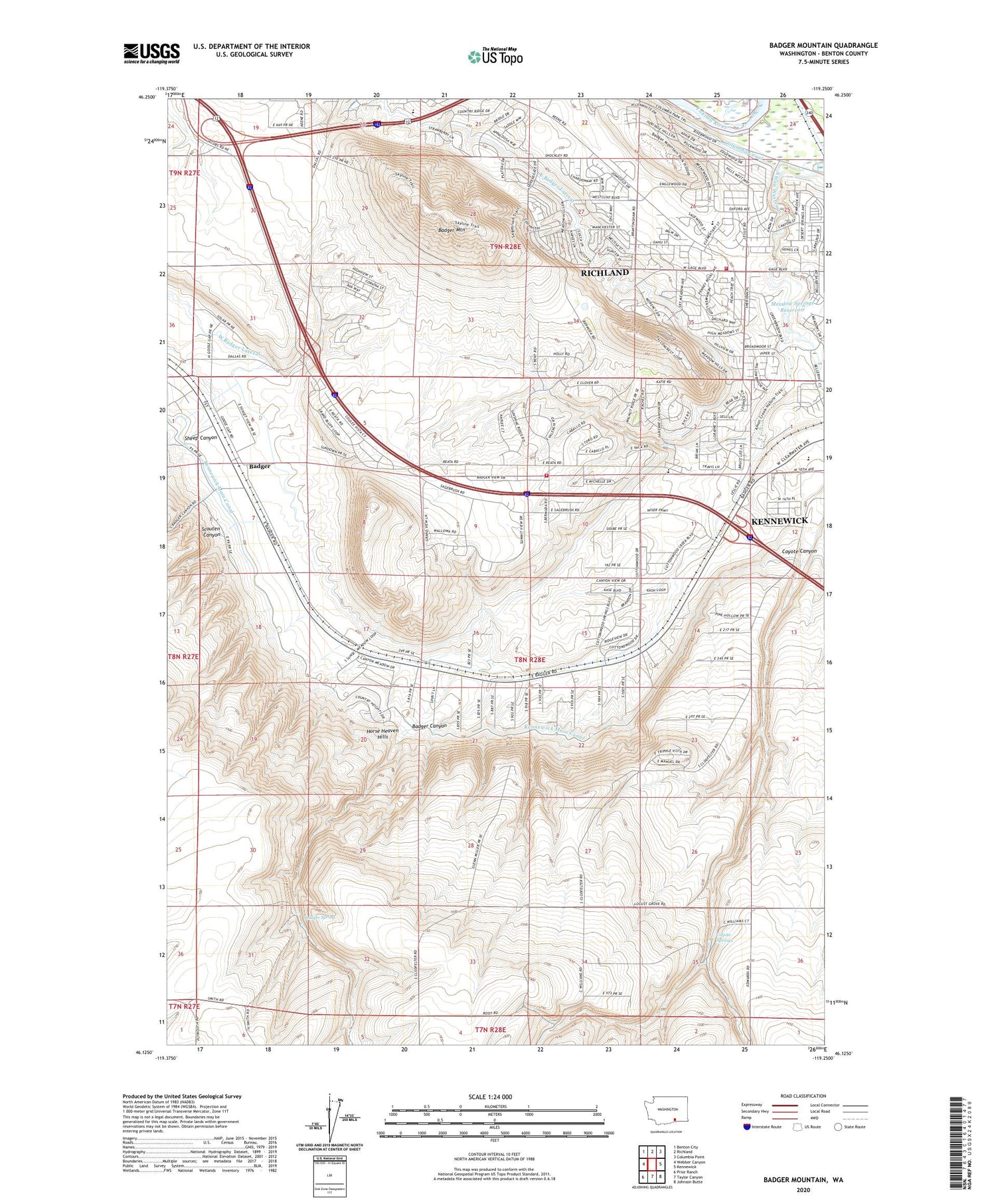
2020 topographic map quadrangle Badger Mountain in the state of Washington. Scale: 1:24000. Based on the newly updated USGS 7.5' US Topo map series, this map is in the following counties: Benton. The map contains contour data, water features, and other items you are used to seeing on USGS maps, but also has updated roads and other features. This is the next generation of topographic maps. Printed on high-quality waterproof paper with UV fade-resistant inks.
Quads adjacent to this one:
West: Webber Canyon
Northwest: Benton City
North: Richland
Northeast: Columbia Point
East: Kennewick
Southeast: Johnson Butte
South: Taylor Canyon
Southwest: Prior Ranch
Contains the following named places: Badger, Badger Canyon, Badger Mountain, Badger Spring, Benton County Fire District 1 Station 140, Columbia Canal, Coyote Springs, East Badger Lateral, Edwards Well, Erie, Goose Gap, Meadow Springs Dam, Meadow Springs Reservoir, Richland Fire and Emergency Services Station 72, Richland-Kennewick Division, Root Well, Scouten Canyon, Sheep Canyon, Sunset View Elementary School, West Badger Lateral, Youngs Well, ZIP Code: 99338


