MyTopo
Capitol Peak Washington US Topo Map
Couldn't load pickup availability
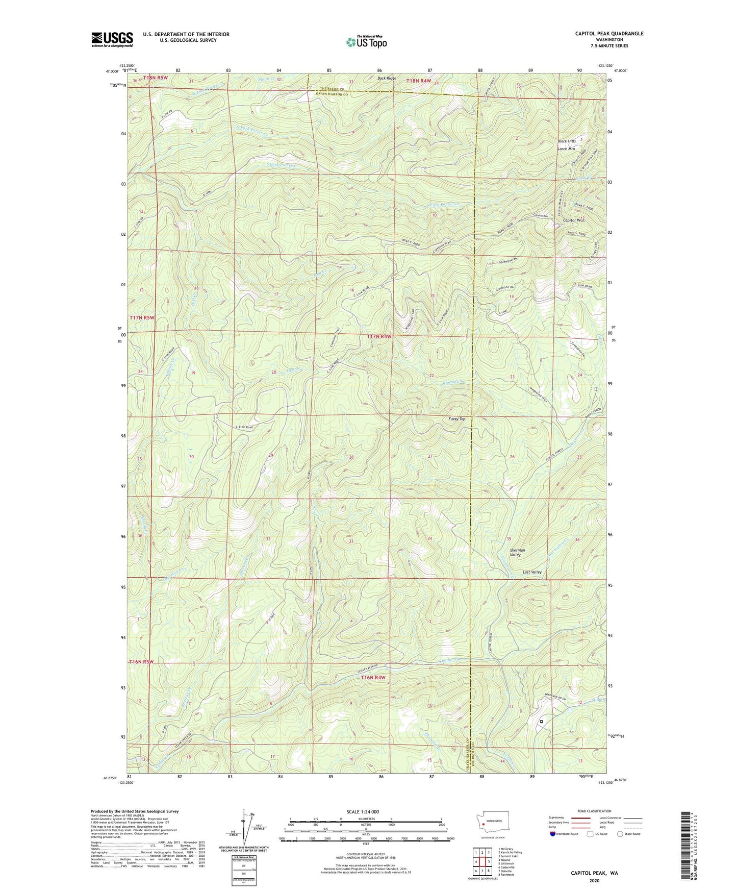
2020 topographic map quadrangle Capitol Peak in the state of Washington. Scale: 1:24000. Based on the newly updated USGS 7.5' US Topo map series, this map is in the following counties: Grays Harbor, Thurston. The map contains contour data, water features, and other items you are used to seeing on USGS maps, but also has updated roads and other features. This is the next generation of topographic maps. Printed on high-quality waterproof paper with UV fade-resistant inks.
Quads adjacent to this one:
West: Malone
Northwest: McCleary
North: Kamilche Valley
Northeast: Summit Lake
East: Littlerock
Southeast: Rochester
South: Oakville
Southwest: Cedarville
Contains the following named places: Black Hills, Bozy Creek, Buck Ridge, Capitol Peak, Capitol Peak Lookout, Capitol State Forest, Cedar Creek State Correction Center, Fall Creek, Fall Creek Campground, Fuzzy Top, Hell Creek, Iron Creek, Larch Mountain, Lost Valley, Lost Valley Creek, Monroe Creek, North Creek, North Creek Campground, North Creek Truck Trail, North Fork Porter Creek, Porter Creek Truck Trail, Sherman Creek, Sherman Valley, Sherman Valley Campground, South Fork Porter Creek, Swan Creek, Thurston Creek, Wedekind Picnic Area